|
|
|
|
|
|
|
|
|
Covid-19 has sure put a stop to in-person meetings and presentations, but that's no reason why chapter meetings and presentations can't still reach out and be available to IAFI members. In fact, several IAFI chapters have been able to increase their outreach and attendance through the use of online 'virtual' meetings and presentations. And as an added bonus, the presentations can be easily recorded and made available online to those who weren't able to attend the live online event.
|
|
|
|
|
|
Of course Nick Zentner of the Ellensburg Chapter has long been producing and posting videos of his public lectures and his 2-Minute Geology and Nick on the Rocks series, as well as a large library of Covid-era explorations of local geology. The Cheney-Palouse Chapter and the Lake Lewis Chapter have also held their own online virtual meetings and presentations including a recent presentation of Ice Age Floodscapes of the Pacific NW by Bruce Bjornstad for the Lake Lewis Chapter. We hope that other chapters can soon follow suit and that recordings of these and other future events can be made available to our larger IAFI membership.
|
|
|
|
|
|
|
|
The Palouse Falls Chapter of the Ice Age Floods Institute hosted their annual Fall tour on Saturday Oct. 26th with a trip through the lower Telford-Crab Creek Scabland Tract and lower Grand Coulee. This was the 5th tour since their formation in 2015. The previous tours were by bus, but due to Covid-19, it was decided to hold this tour by car caravan. It was the second car caravan tour for the chapter.
|
|
Seventeen people checked in at the Ritzville City Park for introductions and instructions. Current protocols for Covid-19 were presented with masks available for anyone who did not have one. Everyone came prepared as all were aware of what needs to be done in this time of pandemic. Not only was there local participation, but guests from as far as Seattle, Lewiston, ID, and Bozeman, MT came to learn more about our incredible flood story. With the restrictions of Covid-19, this trip provided a way for participants to see new areas of the channeled scablands in a safe way during these trying times.
|
|

|
|
Everyone received a guidebook at the start of the trip to explain the stops with detailed directions in case they got separated from the group. The first stop was a coulee at the Marcellus elevator north of Ritzville on the eastern edge of the Telford/Crab Creek Scabland Tract. The caravan then continued to a stop at Crab Creek on Rocky Ford Road. The next stop was north of Odessa to hike around three of the Odessa Craters. The trip continued across the back roads through the Telford/Crab Creek Scablands to Dry Falls in the Grand Coulee for lunch. The next two stops in the lower Grand Coulee were to look at the Coulee Monocline, followed by another hike at the Lenore Caves above Lake Lenore. Continuing south, the caravan arrived on the Ephrata Fan south of Soap Lake. The final stop was above Moses Lake which occupies the last channel of the diverted Columbia River from the time of the floods.
|
|
|
Despite the tour covering a large area with multiple stops, all ten cars that started the trip finished with no one getting lost along the way. Based on their experience with running car caravan tours the leaders of this tour offered a number of "CAR CARAVAN GUIDELINES" that other chapters will find useful for organizing their own car caravan tours, at least until we can safely do bus tours again.
|
|
|
|
|
|
|
|
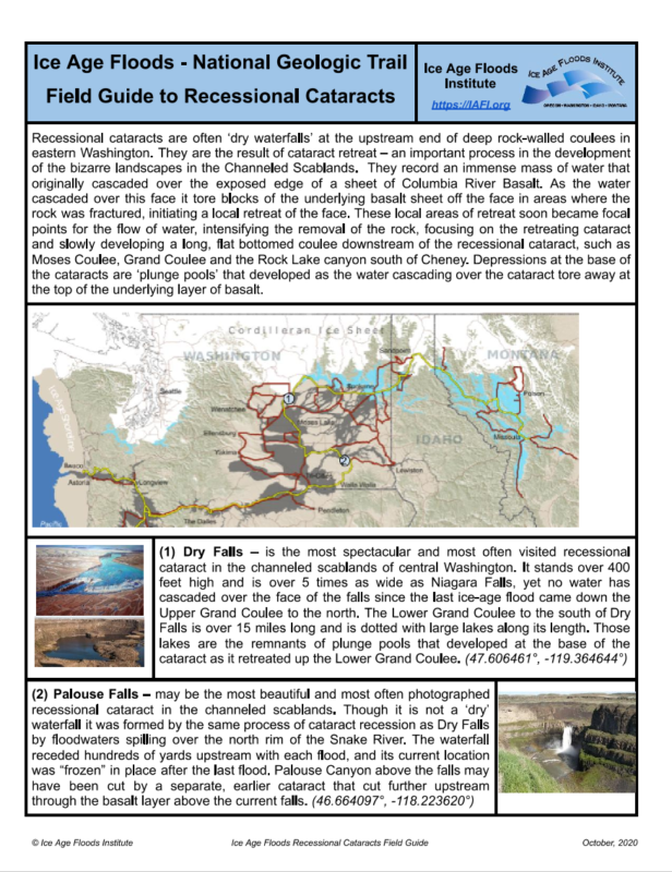
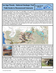
There are abundant Floods Features scattered throughout the Ice Age Floods tracts, but many people do not really know what they are, how they were formed, and in some cases may not even know where to see them. Consistent with the IAFI Mission "to promote public awareness and education relating to the significance of the Ice Age floods", we propose a project to create a series of "Floods Field Guides" to be developed in collaboration with the Nation Park Service's Ice Age Floods National Geologic Trail.
|
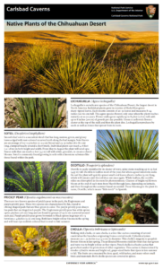
We envision a format similar to the "Native Plants of the Chihuahuan Desert" field guide developed by Kathleen Person of the National Park Service for Carlsbad Caverns National Park.
|
|
|
DRAFT "Recessional Cataracts" Field Guide
|
|
|
|
"Native Plants of the Chihuahuan Desert" Field Guide
|
|
|
As such, each guide will include a general description of a particular type of flood feature (coulee, recessional cataract, etc.) and detailed descriptions of several specific features of that type, as well as specific coordinates for the feature and a regional map showing the general location of each highlighted feature.
|
The guides will be a single two-sided letter-size page in PDF format that can be posted on our website and downloaded for printing on a home printer.
|
|
We hope to involve many of our IAFI members contributing descriptions and images of their favorite features, so this becomes a more or less crowd-sourced product for the benefit of other members and the public in general.
|
|
|
|
|
|
|
|
Do you have a geology question? We might have an answer!
Do you have a geologic fact to share? We have a way to do that!
|
|
Members who want to do a short article, or describe a field trip location of interest, or describe some geologic problem or site, can use our online form to submit a question or write-up to our technical committee for an answer or review before we post it on our Geology Corner page.
|
|
|
|
|
|
|
|
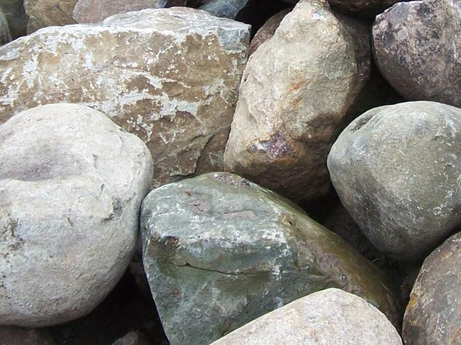
A - Most all of the well-rounded boulders that clutter parts of the floor of the Spokane Valley are, indeed, derived from the Ice Age floods, but are probably were not ice-rafted to their present locations. They were moved by the tremendous power just downstream from the initial Ice Dam failure, rolled or bounced along the bottom of Glacial Lake Columbia and accumulated rapidly in the deeper parts of the lake. The power of the flood currents dissipated as the waters moved west. Most of the large boulders found father west were probably ice-rafted. The source for these boulders was most likely glacial moraine and stream sediments from Idaho, Montana, and Canada, thus no local basalt in the mix. Because they were “current” derived, they are often sorted in size, and derive from a source where there has been much erosion already and well rounded. More information on this can be had in the online Zoom lecture "What Happened When the Dam Burst" by the IAFI on November 24 by Michael Hamilton.
|
|
|
Q - I have noticed places around Spokane where there are large accumulations of similarly-size boulders. They are smooth and generally about a meter in diameter.. The type of stone varies, but none are Columbia Basin basalt. I assume these are ice-rafted erratics. My question is how did so many end up in a few locations and why are they all similarly sized? My guess is that the flood waters ran into a slope and became still enough to drop similarly-sized loads. Is that right? Or is there another explanation? The South Hill Park and Ride has 81 scattered around the site, some of which I assume were pushed out of the way for paving. Another site nearby has perhaps 40 used for a retaining wall. The Spokane Valley YMCA has a lot, as does the parking lot for the Dishman Hills Natural Area. There are also places along Trent Avenue where these stones are found. Thanks for your reply. - James VanderMeer
|
|
|
|
|
|
|
|
|
The Puget Lobe chapter started a new feature to show at the beginning of our in-person Chapter meetings. It introduces the evenings' presenter, future presentations, and announcements about IAFI/Chapter activities. These Chapter announcements are now on a repeating 7-8 minute cycle and generally start about 6:45pm. And, a "newsreel" was created to introduce, such items as, the Milankovitch Theory, or the conditions that setup the environment for creation of Continental Ice Sheets. This subject is not addressed or just referenced in passing at most lectures. We see the geological results and impacts throughout our physical environment here in the NW and northern tier of states.
|
We need to understand how those features came about - it's not just the ice dam near Sand Point, ID; rather the water that formed behind the dam. Yes, the ice came from Canada, tariff free; but how, when, and under what circumstances? The trail to understanding is quite intriguing and a fascinating adventure. So we are going to sleuth our way back to the starting point(s); or, how we arrived at our current theories concerning Continental Ice Sheets. And work our way forward to the Fraser Glaciation of the recent Cordilleran Ice Sheet and how our present surficial features came about.
|
But, we will take lots of side trips, such as: Why was the closing of the isthmus in Panama so important, or what happened to the Equatorial Current of long ago? What is the relationship between the Deccan Traps and our Columbia River Basalt Group (CRBG), or what are Continental Flood Basalts? Stay tuned.
|
|
Each newsreel, with introductions, will be shown in its entirety at least one week prior to the meeting and two weeks after the meeting in a separate post, Puget Lobe Meetings (Meeting for {date}). After that, just the newsreel portion will be included in this post and appended to previous newsreels.
|
|
|
|
|
|
|
|
Are you looking for new geology videos? Nick Zentner has recently begun a new series of "Nick at Home" live geology lectures from his home in Ellensburg exploring "Exotic Terrranes of the Pacific NW", and continues to post them online to his YouTube channel https://www.youtube.com/user/GeologyNick/videos
|
|
Join Nick as he explores the geology of the Pacific NW and many other topics.
|
|
|
|
|
|
Upcoming Calendar Events
|
|
Oct 15 @ 7:00 pm - “The Meaning of Climate Change” with David Osborn
|
|
Oct 21 @ 7:00 pm - Downtown Geology Lecture Series
|
|
Oct 29 @ 7:00 pm - “Ice Age Floodscapes of the PNW: A Photographic Exploration” with Bruce Bjornstad
|
|
Nov 2 @ 6:45 pm - “The Great Seattle Earthquake” with Tom Hopp
|
|
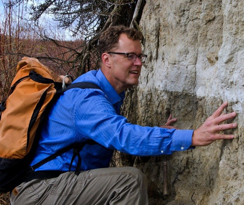
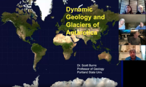
Nov 10 @ 6:45 pm - Zoom Program with Scott Burns
|
|
Nov 19 @ 7:00 pm - “Guatemalan Volcanoes”
|
|
Nov 24 @ 7:00 pm - “What Happened When The Dam Burst?” with Michael Hamilton
|
|
Jan 12 @ 6:45 pm - Zoom Program with Dr. Ellen Morris Bishop
|
Jan 14 @ 7:00 pm - “Growing Up Under the Ice Dam” with Dr. Dave Daugharty
|
|
|
|
Parting Notes
|
|
|
|
|
|
Since June the IAFI Board of Directors have been working to revise and update the IAFI Strategic Business Plan that was created in 2006. A lot of that plan has been achieved since then, while some parts are still actively being addressed and other parts are no longer relevant.
|
|
|
|
The newly revised plan that was officially adopted in our October 10 board meeting lays out goals, strategies and action plans for the next two years that address Membership Services, Trail Advocacy, Education and Outreach, Organization Leadership, Administration and Finance. Five committee teams (Education and Outreach, Technical Committee, Membership Services, Trail Advocacy, Administration and Finance) were charged with identifying specific goals, strategies and action plans, and "champions" were assigned to push the action plans forward and to report progress at our regular board meetings.
|
|
The full 28-page 2020 Ice Age Floods Institute Strategic Plan is available online and we anticipate reporting regularly on our progress as we work to continue the IAFI Vision to be "the foremost provider of Ice Age floods scientific advice and marketing communications through member, partner and direct public collaborations", and Mission to be "dedicated to promoting public awareness and education relating to the significance of the Ice Age floods"
|
|
|
|
|
|
Ice Age Floods Institute (IAFI) is a 501(c)(3) tax-exempt, non-profit educational organization (EIN 91-1658221), founded in 1995 and recognized as an official authority on the Ice Age Floods, providing accurate, scientific-based advice to members and the public. We were instrumental in 2009 Federal legislation authorizing National Park Service designation of the
Ice Age Floods National Geologic Trail (IAFNGT).
|
|
|
|
|
|
|