|
|
|
|
|
|
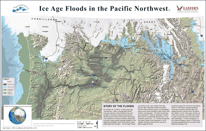
A Few Ice Age Floods Sites to Explore This Summer
|
|
|
|
|
|
|
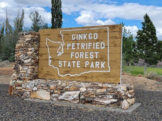
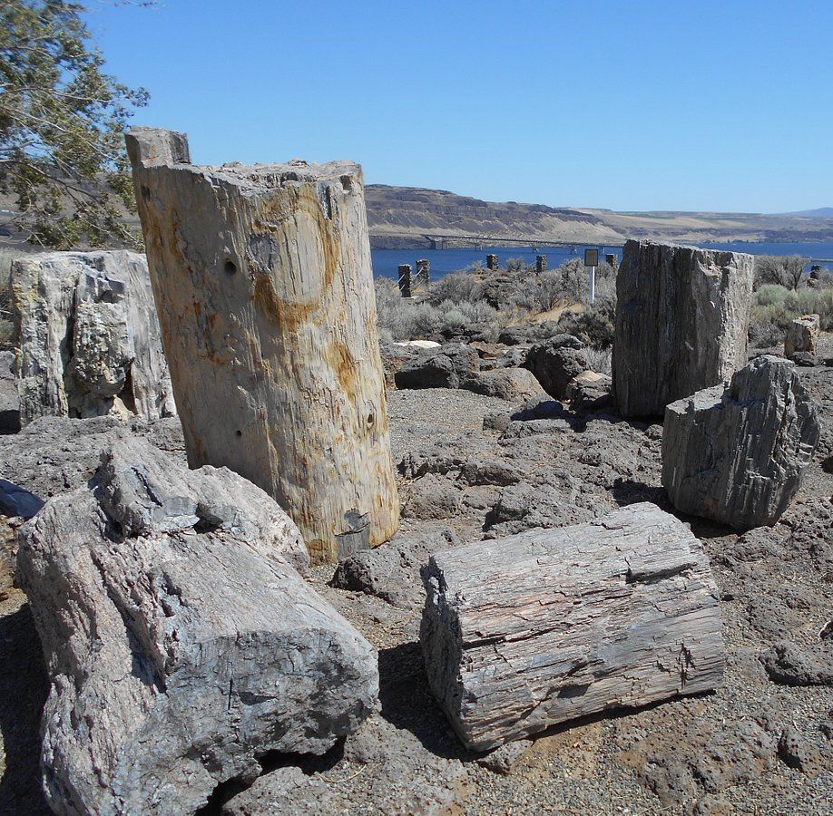
Ginkgo Petrified Forest State Park is a registered National Natural Landmark, lyng just north of US-90 at exit 136, and west of the Wanapum Lake portion of the Columbia River at Vantage, WA. Established in 1935, it is home to a rare and vast collection of petrified trees. The park covers 7,124 acres, including an interpretive trail, on which visitors can hike and see protected displays of several of the petrified tree species.
|
|
|
|
The abundance of tree species discovered here make it one of the most diverse collections of petrified trees in North America. The trees are thought to have been carried down the flanks of ancient volcanoes from various ecological zones by floods and lahars., and then deposited and buried in an ancient lakebed. Slowly, cell-by-cell, the tree cells were replaced by dissolved minerals in the groundwater, resulting in exact rock replicas of the trees.
|
|
The park comprises three primary locations.
|
|
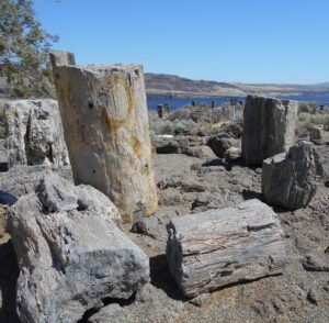
Drive a couple of miles up the Old Vantage Highway to the Ginkgo "Trailside Museum", constructed by the Civilian Conservation Corps in the 1930s, and recently updated with a new interpretive exhibit. From here, 1.25 miles of the Trees of Stone Interpretive Trail wind past more than 20 petrified logs protected in their original settings with signage about the petrified wood. Birders look for golden eagles, sage thrashers, Say’s phoebes and many other species. Elk and bighorn sheep also frequent this area. A total of 3 miles of hiking trails are at this site.
|
|
|
Perched on a cliff face carved out by Ice Age floods, Ginkgo Petrified Forest Interpretive Center overlooks the Wanapum Lake portion of the beautiful Columbia River. The access road is marked by a small sign on Main St. just north of the small town of Vantage. The interpretive center was constructed by the Civilian Conservation Corps during the Great Depression and was later expanded in 1951.
|
|
The air-conditioned Center museum features a beautiful collection of more than 30 varieties of petrified wood, videos and park volunteers to inform visitors about the history behind this unique and unusual petrified forest. They can also tell about the powerful Ice Age Floods, responsible for the visually captivating surrounding landscape. Outside the Center, visitors can enjoy the day-use/picnic area, view the scenic river, touch petrified wood and learn more about the Ice Age Floods.
|
|
|
|
|
Ginkgo Petrified Forest State Park is also home to the Wanapum Recreation Area about 3 miles south of US-90, which features 27,000 feet of freshwater shoreline and hosts a 50 site, full hook-up campground, a day use area with a swim beach, and a boat launch. Read more
|
|
|
|
|
|
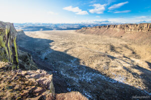
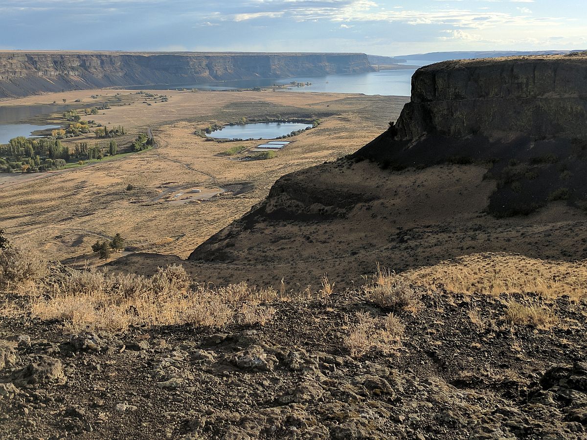
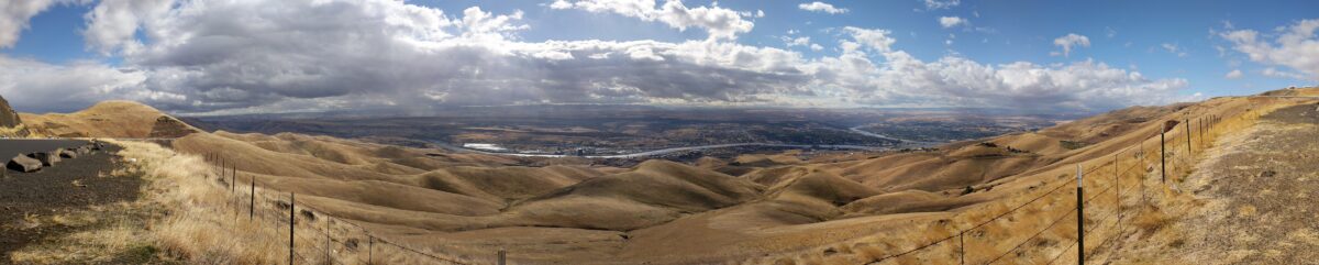
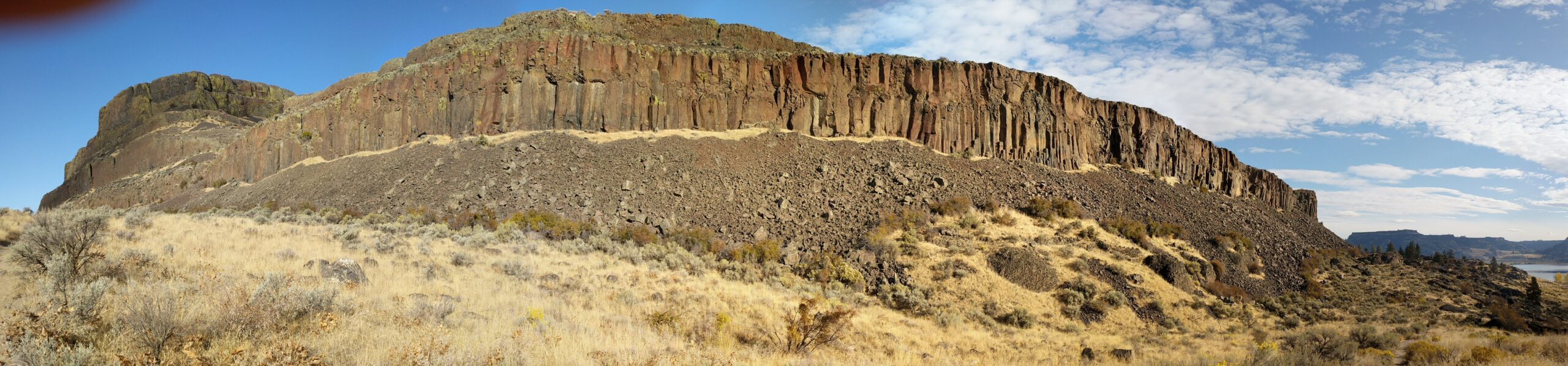
Frenchman Coulee is a short drive north and west from the Silica Road exit 123 off US-90, along the Old Vantage Road. It is one of the most beautiful features left behind by the great Ice Age Floods.
|
|
Several of those massive floods, up to 700 ft (213 m) deep, created Frenchman Coulee, its Potholes Coulee neighbor to the north, and scoured the bizarrely eroded surface of Babcock Bench, preferentially eroding weaker rock out of the top of the Grand Ronde Member of Columbia River Basalt.
|
|
|
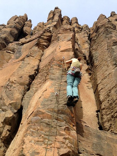
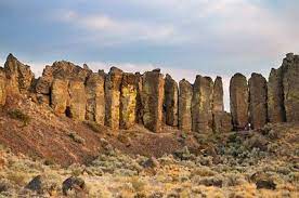
Frenchman Coulee is actually a dual coulee and cataract system, Frenchman Coulee and Echo Basin, separated by a remnant rock blade that sports tall basalt columns attracting rock climbers like bees to flowers. The Feathers is probably the most popular climbing area in the region.
|
|
|
|
Hiking trails, some barely discernible, lead along and atop the rock blade, affording spectacular views of both coulees. Frenchman Coulee also has a waterfall in the eastern section of the Coulee that is accessible by foot.
|
Other hiking and biking trails explore the floor of the coulee and continue over 15 miles north along Babcock Bench, perched high above and adjacent to the Columbia River, past Potholes Coulee and on to Crescent Bar.
|
|
|
|
|
|
|
|
|
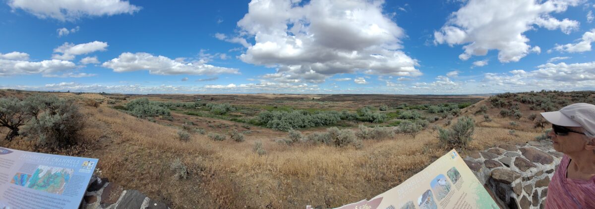
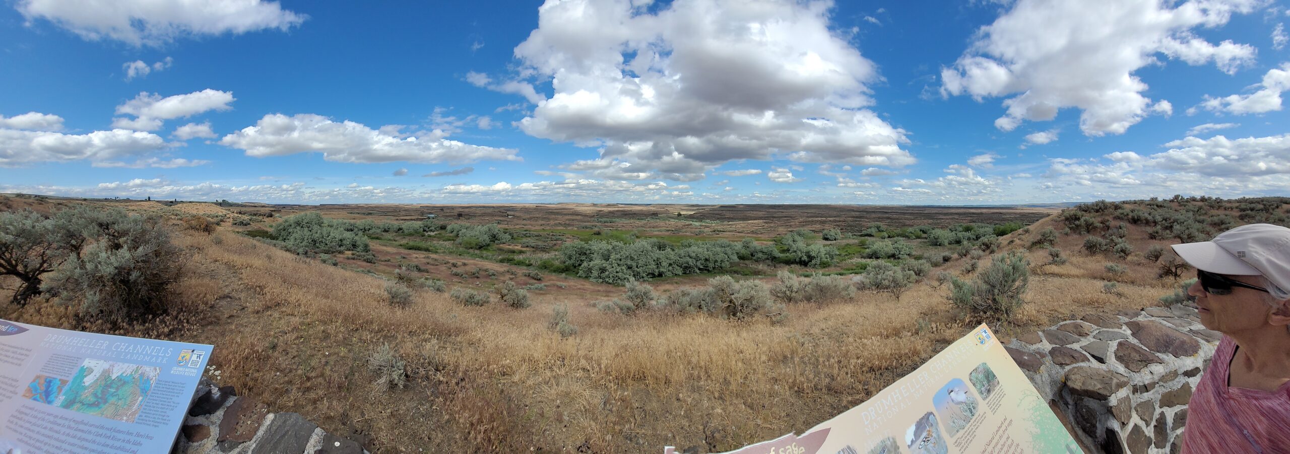
There are scads of hiking trails all through Drumheller Channels National Natural Landmark. On a cloudy day in early June we took off on a couple of exploratory hikes that were simply amazing.
|
|
|
We first proceeded south from the parking lot at Lower Goose Lake, running through late Spring wildflowers, eventually looking for one of Bruce Bjornstad’s geocaches. We wandered over hills and down into deeper valleys, always surrounded by the towering walls of basalt defining that section of Drumheller Channels.
|
Along the way we found an area of apparent Kolk depressions with odd spires of basalt poking up out of the middle of a central mound. Soon we passed through a reedy area that bounded the southern edge of Lower Goose Lake.
|
|
We continued on south to the edge of Black Lake where the geocache was supposed to be, but after 20 minutes with 4 of us looking in the area of the GPS coordinates, we finally decided the cache was no longer there and headed back.
|
|
|
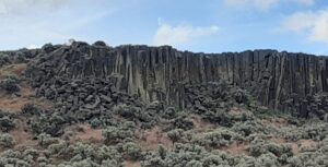
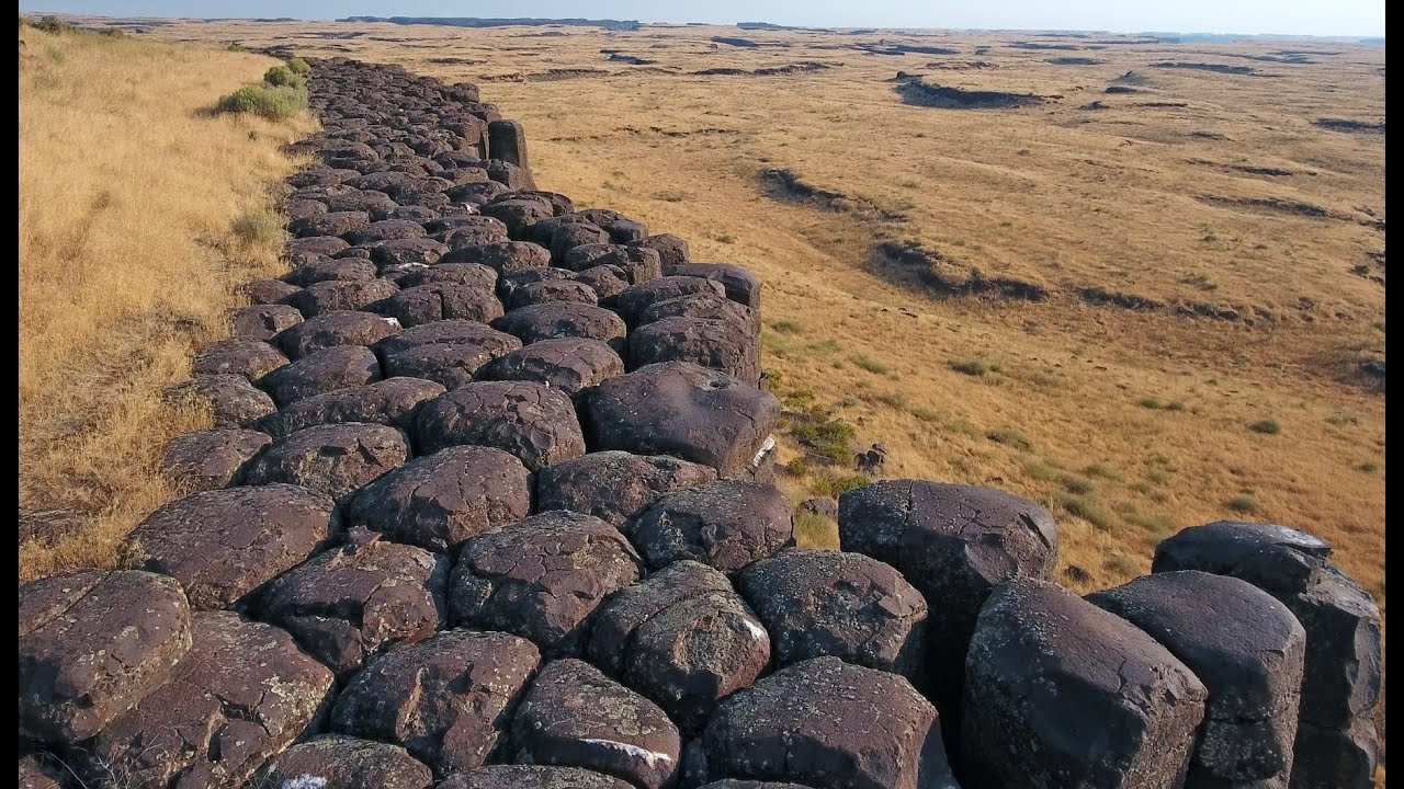
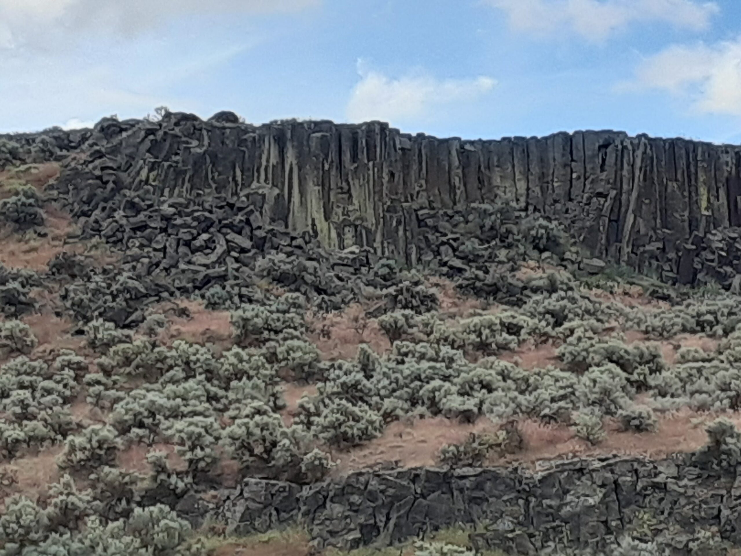
We then drove north across the O’Sullivan Dam, and back south through Columbia National Wildlife Refuge to the W. McManamon Road entrance to Crab Creek Marsh Unit #3 and the Basalt Columns at Drumheller Trailhead, the kickoff point to go to the top of “Nick’s Columns”. Nick Zentner’s videos about the columns are great, but the blooper where his rock hammer falls down between columns is priceless. We just had to see those columns for ourselves, and we weren’t disappointed.
|
|
|
|
|
It’s interesting how only the columns along the edge are free standing, while those inboard are packed around with sediment. The little rain the area gets probably washed the sediment out of the spaces between the bordering columns.
|
|
|
After walking around for a while more we made our way back to the car and drove to the Drumheller Channels National Natural Landmark overlook for a final sweeping viewpoint. The entire area is huge and worth several days of exploring, but it’s also pretty easy to have a great time in just a few hours. This is a place you just have to experience. And the hiking is easy. If it's cloudy it can also be mercifully cool.
|
|
|
|
|
|
|
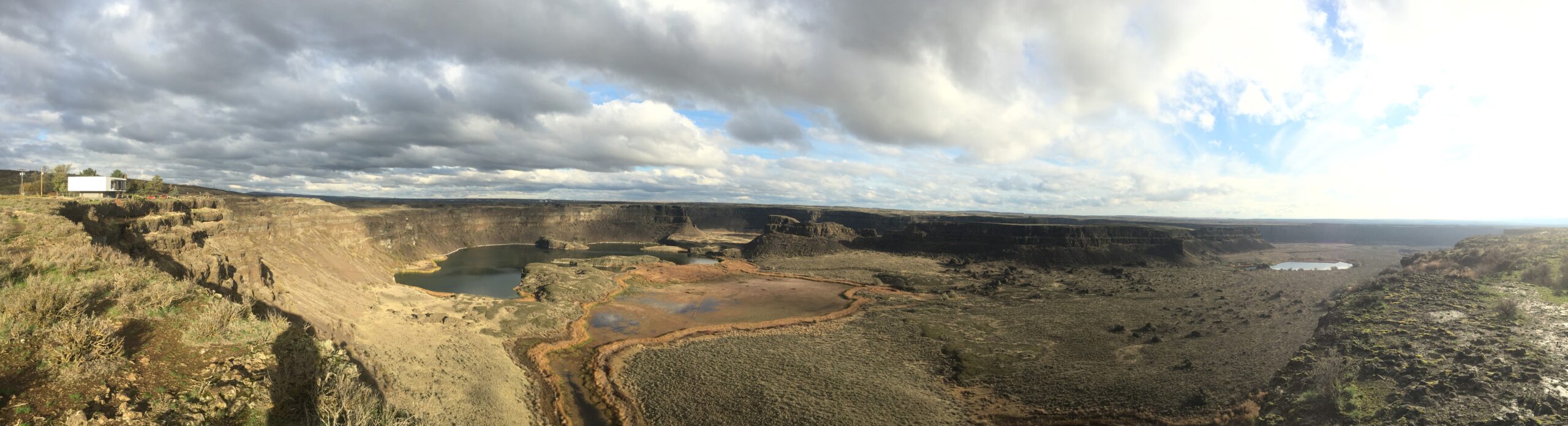
David McWalter, Interpretive Ranger for Washington State Parks, shares a brief video panorama of the spectacular Dry Falls feature in the middle of the Grand Coulee. It gives a sense of the sweep of the landscape, but no video can match actually being there and seeing it with your own eyes. Enjoy!
|
|
|
|
|
|
|
|
|
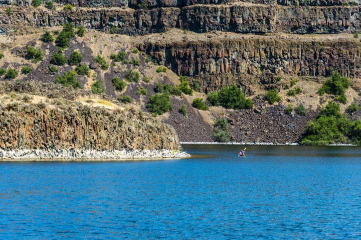
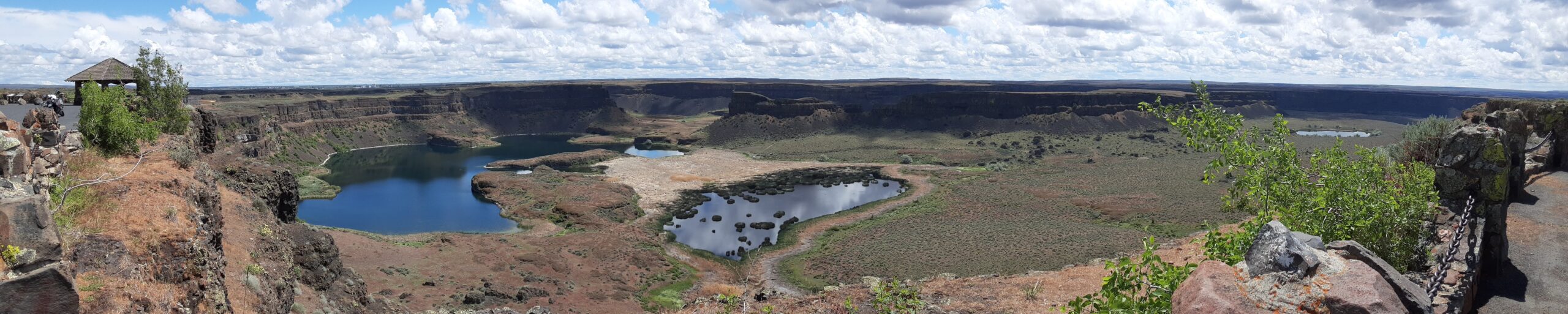
Most Pacific Northwesterners know how awesomely majestic and stunningly beautiful Dry Falls is, if only from the pictures that seem to show up everywhere. If you haven’t been there in person yet you definitely need to make that trek into central Washington. The drive through the lower Grand Coulee, as awesome as it is, is only the teaser for the view from the Dry Falls Visitor Center. But if you really want to get into the majesty, consider taking a kayak down to Dry Falls Lake or Deep Lake, at the base of those monstrous cataracts.
|
|
|
|
The dirt road to Dry Falls Lake isn’t for the faint of heart, and a good, high clearance SUV is recommended. But paddling the lake near the base of those 400 foot high cliffs is worth the effort. Bordered by reeds and accompanied by waterfowl, an hour-long paddle around the lake is leisurely, relaxing, and totally absorbing. And who knows, you might end up in someone else’s fantastic photo of Dry Falls from the Visitor Center.
|
|
|
|
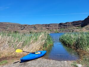
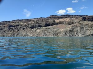
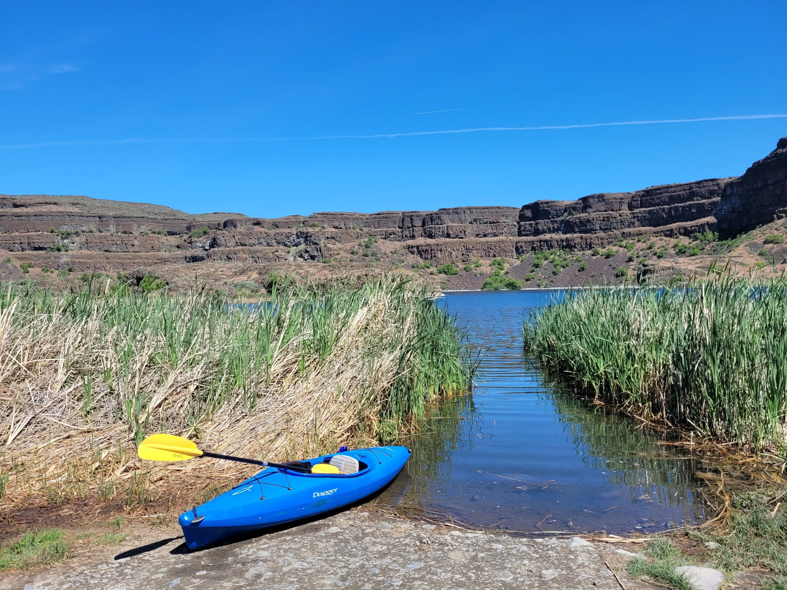
The road to Deep Lake is paved, so it is a much easier place to get to. And the ramp at the lake makes getting in and out pretty easy… just be careful of the slippery algae on the ramp. Once you’re on the lake an hour’s paddle will take you from an area bordered by rolling hills to a section bounded by high vertical walls.
|
|
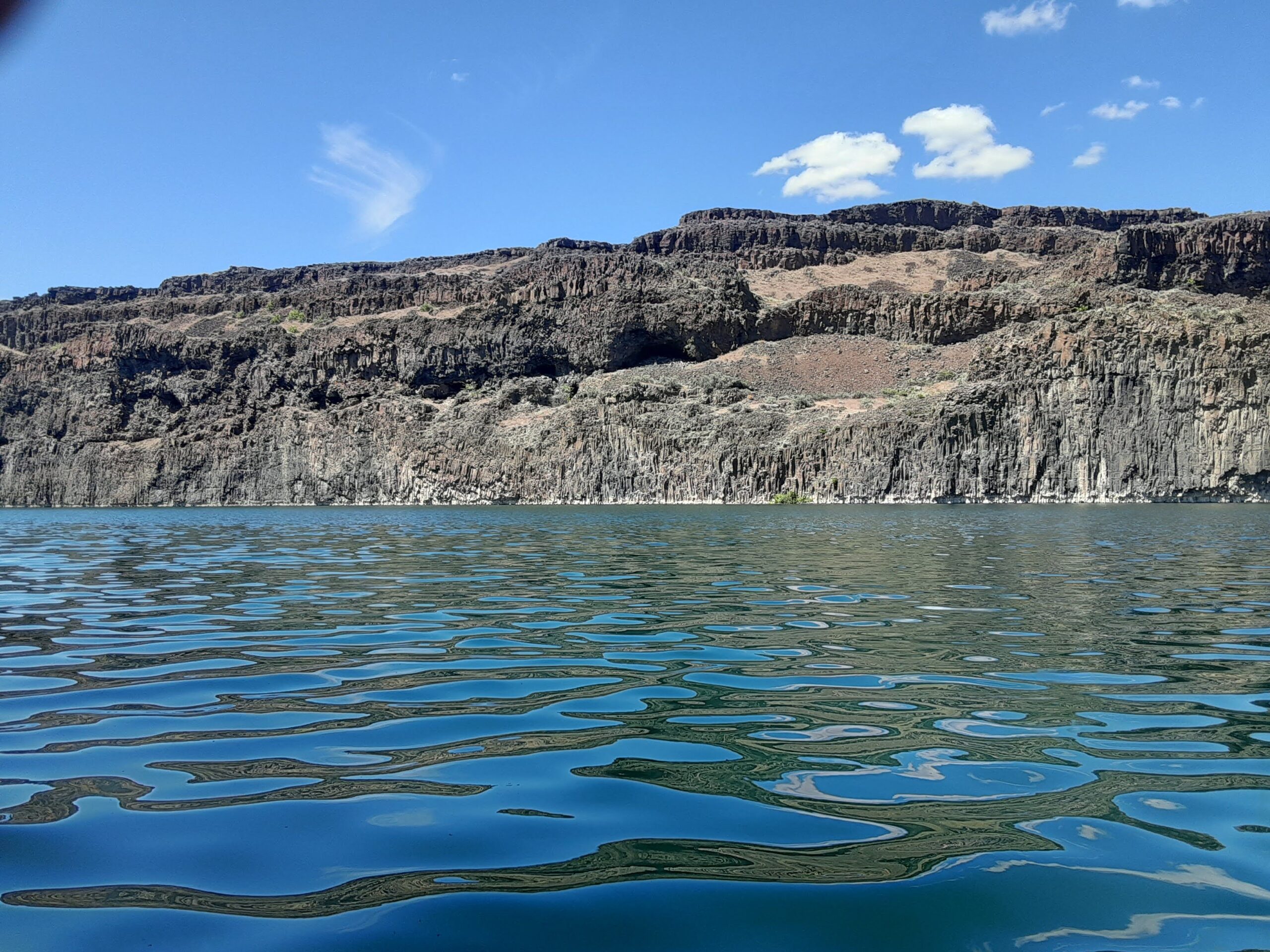
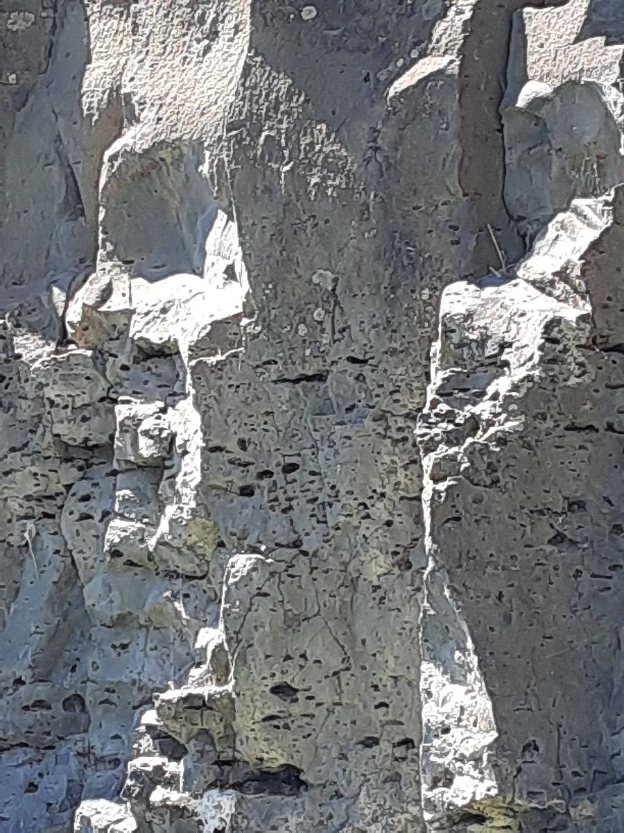
Don’t fall out in this area because there’s nowhere to climb out or beach your boat to climb back in. Still, it’s astoundingly interesting to get up close and see the variety of textures in the basalt walls.
|
|

|
Of course, you can also do some great hiking in both areas, though climbing the blade takes quite a bit of effort and confidence, but the view is pretty spectacular. Unfortunately, the way back down isn’t any easier than the way up. Choose your route carefully.
|
|
|
|
|
|
|
Steamboat Rock lies at the very northern end of the Grand Coulee. At over 1 mile long, ⅔ mile wide, and 800 feet high. The basalt-topped butte standing alone in the middle of the coulee, almost completely surrounded by the waters of Banks Lake is an incredible sight. It was left behind by erosion of both the Ice Age Floods that carved the Grand Coulee, and the Okanogan Lobe of the ice-age continental ice sheet.
|
|
|
|
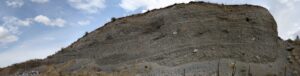
Because this area is near the thinning outer margin of the Columbia River Basalt extent, it’s easy to see Columbia River Basalt directly overlying older granitic basement from the trails around the base. A steep climb on a well constructed trail leads to the broad top of Steamboat Rock where the views are truly expansive, encompassing a full 360° panorama. It’s also easy to find granitic erratics and glacial till atop the butte that attest to the fact that the Okanagan Lobe overrode Steamboat Rock during the most recent Ice-Age glacial advance.
|
|
|
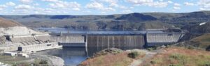
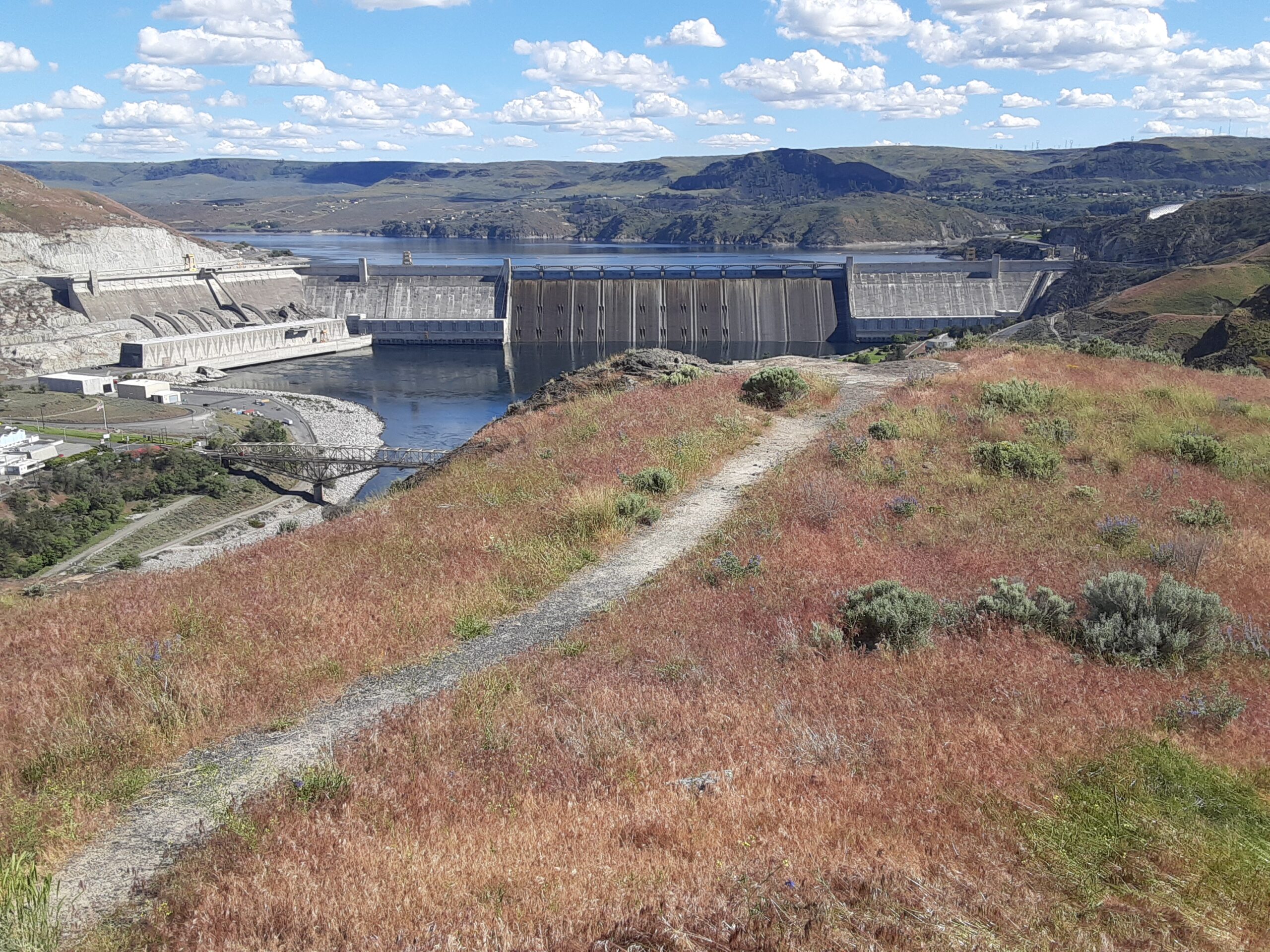
The campgrounds at the State Park are spacious and well laid out. There is easy access to both the trails and to Banks Lake for fishing, boating and swimming. Most of the water in Banks Lake has been pumped up from the Columbia River’s Lake Roosevelt, and impounded by a dam 20 miles south at Coulee City. Banks Lake is a key element in the Columbia Basin Project that supplies water for the verdant agricultural areas to the south in an otherwise quite dry, high desert environment.
|
|
|
|
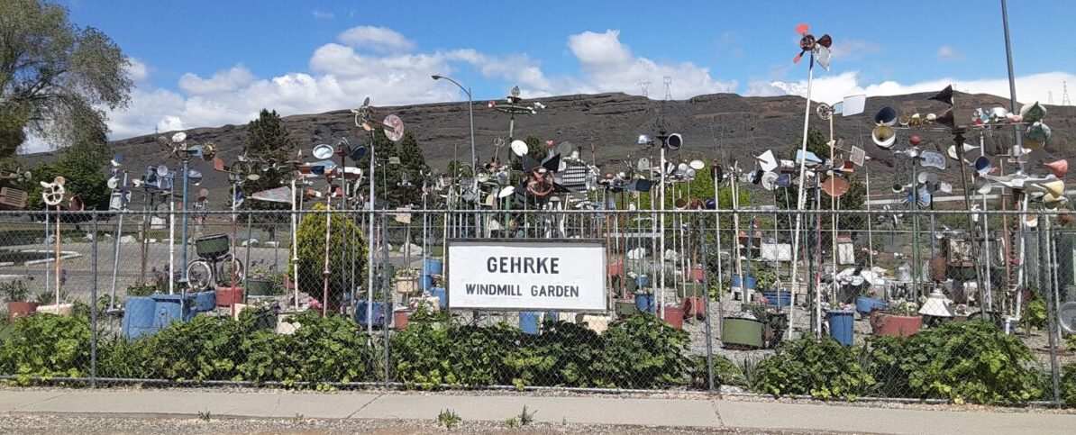
Some other interesting places to explore in the area include Northrup Canyon, Grand Coulee Dam, and the quixotic Gehrke Windmill Garden just north of Electric City.
|
|
|
|
|
|
|
|
|
|
|
|
|
IAFI and Chapter News
|
|
|
|
|
|
|
|
|
Click on the map to go to the Store item.
|
|
|
The IAFI Store sale on three of its most popular maps is extended through September to help vacationers better track their Ice Age Floods explorations. All large (24" x 36") maps of "Ice Age Floods in the Pacific Northwest" will be priced at $17.50 each. The smaller 11" x 17" laminated version will be on sale for $12 and the unlaminated 11" x 17" paper version will be $10 during that period. The sale is limited to our stock on hand, so purchase before stocks run out.
|
|
|
|
|
|
94 years after the original dedication of Dry Falls as a State Park, Dry Falls Visitor Center is hosting Floodfest 2022 on July 23rd, 2022, 10 AM – 3 PM! We are going to celebrate ALL things related to Ice Age Floods in the Pacific Northwest and Washington State Parks too! Booths & tables will be set up outside during the day, with various Federal, State and Private organizations to help tell the story of the Ice Age Floods, Geology, Wildlife, and History.
|
|
An arts & crafts table will be set up for folks to draw, color, and/or paint their ‘Impressions of the Park’. The “Impressions of the Park” program is a weekly arts and crafts program done in addition to the various table top Interpretive programs at the Dry Falls Visitor Center. Many talented ‘ologist will also be there to help folks learn about Geology, Archeology, Anthropology, Geography, Biology, and even Pedology (it might get dirty or muddy).
|
|
|
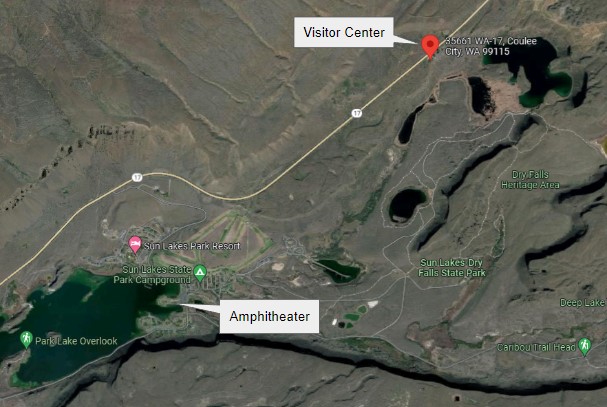
Please note the Visitor Center is located at 35661 HWY 17 North, Coulee City, WA, which is on the highway, not down the access road into the coulee where the Sun Lakes-Dry Falls Park camping area is.
|
|
|
|
In the evening 8:30 PM – 10 PM, visitors will gather at the amphitheater at Sun Lakes – Dry Falls State Park, for a short interpretive program on the Ice Age Floods and a couple of movies:
|
|
|
|
|
The amphitheater area is down the access road into the coulee. 34875 Park Lake Rd NE, Coulee City, WA 99115. For more information check out the Flood Fest Itinerary
|
|
|
|
|
|
|
|
|
|
|
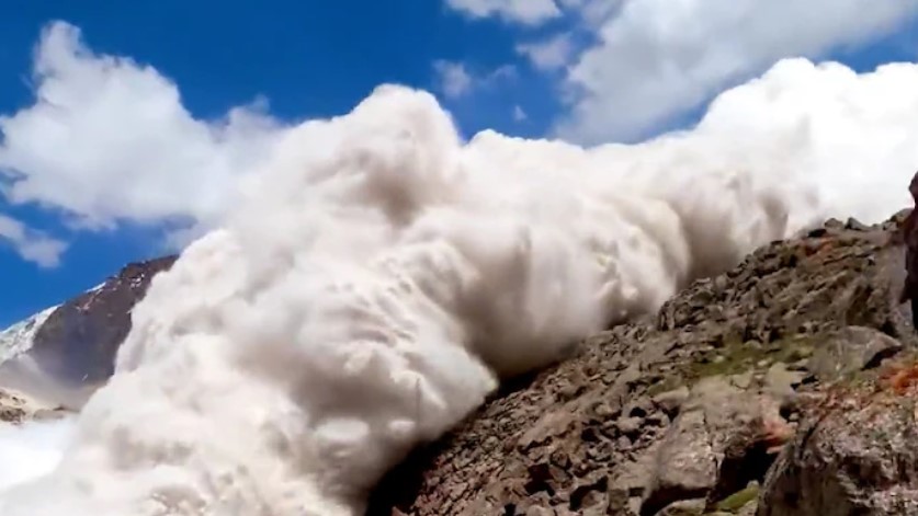
On Friday,July 8 around 2:45 p.m., British tourist Harry Shimmin reached the highest point in his trek along the Jukku pass in the Tian Shan mountains in Kyrgyzstan. He separated from the group to take pictures from the edge of a cliff when he heard deep ice cracking behind him. He turned around to an avalanche of glacial ice and snow rushing toward him and within moments found himself in a blizzard.
|
|
The avalanche was the second glacier collapse of the week, demonstrating the perils of human-caused climate change amid a blistering hot summer in parts of Europe and Asia. These are glacier ice avalanches, rather than primarily snow, in which a glacier broke off and collapsed under the force gravity. The high density of ice added speed and weight to the avalanche. In the Tian Shan event, glaciologist Peter Neff, of the University of Minnesota, pointed out that there was no apparent snow around the mountain so the avalanche was largely a solid chunk of glacial ice. In high mountain regions with permafrost, warm temperatures not only destabilize the glacier ice but also the density of the ice around it. “It’s very dense, more like a landslide than an avalanche,” he said.
|
|
|
|
“The British trekker is indeed, as he is aware, very lucky to be alive in the case of the Kyrgyzstan event,” added glaciologist Jeff Kargel, a senior scientist at the Planetary Science Institute. “A pretty solid hypothesis is that as temperatures warm climate warms, the amount of melting increases,” Kargel said. “The effects of meltwater on destabilizing ice masses increases, and so the number, the frequency and magnitude of glacier ice avalanches should be increasing … and that does seem qualitatively to be the case.”
|
Daniel Farinotti, a glaciologist at ETH Zurich, agreed. “It is long known that meltwater caused by high temperatures increase the pressure in the glaciers’ subglacial drainage system, which in turn can accelerate glacier motion,” said Farinotti in an email. “This increase in pressure and motion have certainly a role to play in such collapses.”
|
Among the greatest downstream effects from such mountain glacier loss and collapses are on fresh water systems, Neff said. For instance, glaciers in High Mountain Asia play a critical role in funneling freshwater into river basins used for drinking, irrigation and hydropower by nearly 1.5 billion people.
|
|
|
|
|
|
Do you have a geology question? We might have an answer!
Do you have a geologic fact to share? We have a way to do that!
|
|
Members who want to do a short article, or describe a field trip location of interest, or describe some geologic problem or site, can use our online form to submit a question or write-up to our technical committee for an answer or review before we post it on our Geology Corner page.
|
|
|
|
|
|
Upcoming IAFI Calendar Events
|
|
Thu July 21 @ 7:00 pm – 8:00 pm :“Ancient Megafloods on Mars” by Dr. Victor Baker @ Zoom Meeting - Lower Columbia Chapter & Tualatin Historical Society
|
|
Sat July 23 @ 10:00 am – ??? pm: Floodfest 2022 at Dry Falls, July 23rd, 10 AM – 3 PM @ Dry Falls Visitor Center and Vista House, Movies afterward at the Amphitheater
|
|
Thu Oct 6: UNESCO International Geodiversity Day
|
|
|
|
Thank You IAFI Member Supporters
|
Every member at every membership level is vital to IAFI’s continued success. Your support helps us meet our mission of providing the Ice Age Floods story to the public and continuing our work on the Ice Age Floods National Geologic Trail. Every gift counts, no matter the size. Thank you for making the IAFI what it is today and for helping shape it for the future.
|
|
|
|
|
|
Ice Age Floods Institute (IAFI) is a 501(c)(3) tax-exempt, non-profit educational organization (EIN 91-1658221), founded in 1995 and recognized as an official authority on the Ice Age Floods, providing accurate, scientific-based advice to members and the public. We were instrumental in 2009 Federal legislation authorizing National Park Service designation of the
Ice Age Floods National Geologic Trail (IAFNGT).
|
|
|
|
|
|
|


