Skip to content
Sharing the Fascinating
Ice Age Floods
Story Since 1995
Explore!
Intro to the Ice Age Floods
Ice Age Floods National Geologic Trail
NPS Teacher’s Curriclum Guide
Places to Go! and Things to Do!
Montana
Idaho
Washington
Oregon
Ice Age Floods Interactive Map
Explore Ice Age Floods Videos
News & Events
IAFI News
IAFI Events
Activities
Presentations
Other Events
IAFI Archives
More News From Our Archives
Join/Renew/Donate
About IAFI
IAFI Board of Directors
Become a New/Renewing Member!
Donate to IAFI
IAFI Chapters
All Chapters Home Page
About IAFI
Explore the Ice Age Floods with IAFI Chapter Brochures
Cheney-Spokane
Coeur du Deluge
Columbia River Gorge
Ellensburg
Glacial Lake Missoula
Lake Lewis
Lower Columbia
Lower Grand Coulee
Palouse Falls
Puget Lobe
Wenatchee Valley Erratics
Education
IAFI Education Grants
IAFI Store
IAFI Store Home Page
Books
Prints & Posters
Maps
Videos & DVDs
Apparel
General Merchandise
Cart
Checkout
Resources
Intro to the Ice Age Floods
Ice Age Floods Interactive Map
Explore Historical Field Research with Google Maps
IAFI Pleistocene Post Newsletters
Field Trips & Field Guides
Field Guides Collection
WSU Field Trips Last – Reidel
Ice Age Floods Videos
Science Corner
Science Corner Page
Science Corner Articles
General Resources
Educator Resources
Online Resources & Maps
Technical Articles
Geology Terms
IAFI Documents
IAFI Chapter Brochures
IAFI Board Minutes
IAFI Legal Records
IAFI Website Articles
Contact Us
Contact IAFI
IAFI Board of Directors
Search
IDAHO PLACES To Go, Things To Do
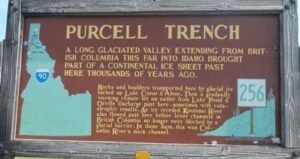
PURCELL TRENCH – THE FLOODS BREAK-OUT AREA
Coeur du Deluge
Must See Floods Features in Northern Idaho
Read More »
July 11, 2023
Idaho
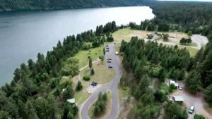
Farragut State Park
Read More »
August 12, 2022
Idaho
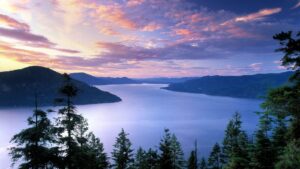
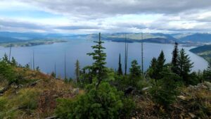
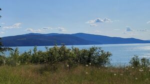
Lake Pend Oreille
Read More »
August 12, 2022
Idaho
Clark Fork Ice Dam
Read More »
August 12, 2022
Idaho
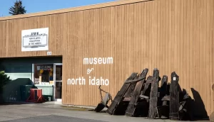
Museum of North Idaho
Read More »
August 13, 2022
Idaho
Green Monarch Ridge
Read More »
August 12, 2022
Idaho
Glacial Dam at Green Monarch Ridge View Point
Read More »
August 12, 2022
Share this article:
Share on Facebook (Opens in new window)
Facebook
Share on Mastodon (Opens in new window)
Mastodon
Email a link to a friend (Opens in new window)
Email
More
Share on WhatsApp (Opens in new window)
WhatsApp
Share on Pinterest (Opens in new window)
Pinterest
Share on Reddit (Opens in new window)
Reddit
Share on Tumblr (Opens in new window)
Tumblr
Like this:
Like
Loading...
%d