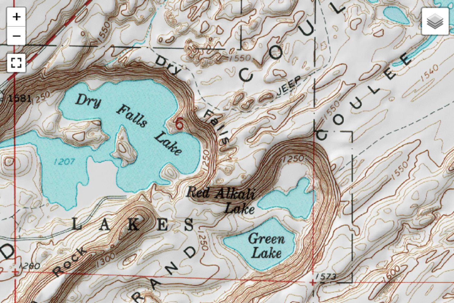
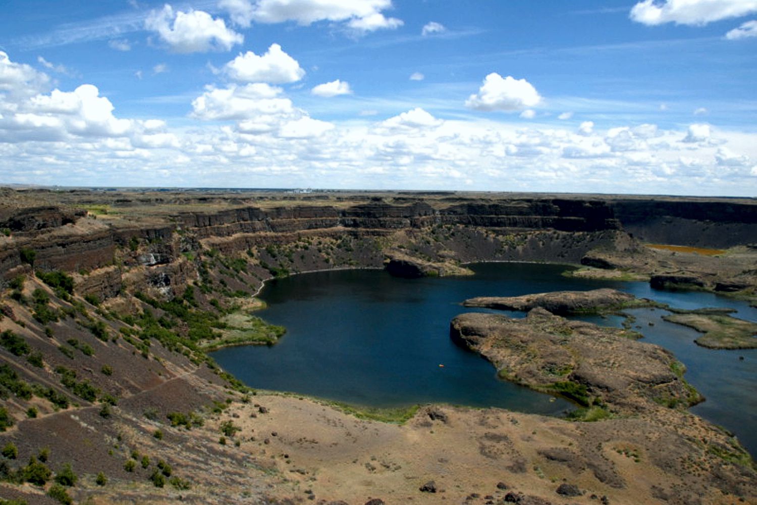
 Q – I am a long time resident and have been to Dry Falls several times. Can you please tell me the elevation change between the top of the falls to the lake below ? Do you know or can you direct me to the information? Thank You!
A – The height is often cited as 400′ but it appears to be a bit over 500′ based on USGS topographic maps.