How do we know how old Earth is?
By measuring radioactive elements in rocks from Earth and other


By measuring radioactive elements in rocks from Earth and other
Spring is coming and the trail is starting to wake
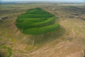
Appearing much different than the nearly ubiquitous Columbia River basalt
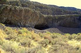
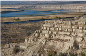
Tucked into the Lenore Canyon are the Lake Lenore Caves. Along
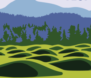
During the last ice age, which route was taken by

Timing, Topography and Type (“Rock Type” that is) Most of

Palouse Falls is visited by thousands each year. The number
Missoula Strandlines Eddy Narrows Beacon Rock Cape Disapointment I’d like

The Othello Sandhill Crane Festival announced the 2023 theme as
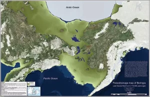
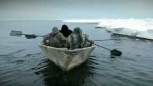
By reconstructing the sea level history of the Bering Strait,
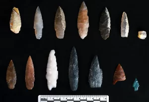
Oregon State University archaeologists have uncovered projectile points in Idaho

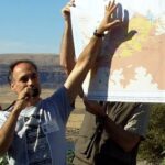
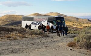
Ken Lacy of the IAFI Wenatchee Chapter hosted an information
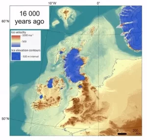
The rapid decline of the British-Irish Ice Sheet thousands of

Bruce Bjornstad is honored to have his photo of Dry


Check out this video about the Washington 100, a cool new geotourism website by the Washington Geological Survey featuring 100 places to experience amazing geology in Washington State. Then explore the website itself at wa100.dnr.wa.gov

There’s a Columbian Mammoth hiding out in Coyote Canyon down Kennewick way, and MCBONES Research Center Foundation is working to uncover his/her hiding place. For a small contribution you can tour this hide-and-seek site, or you can volunteer to help uncover the hidden mammoth. Sound interesting? Find out more in

Check out this 2-Minute Geology expedition with Nick Zentner and Tom Foster exploring the Giant Current Ripples at West Bar and Camas Prairie. Ice age floodwater 650 feet deep – moving at 65 miles per hour – left Giant Current Ripples along the Columbia River at West Bar! The ripples
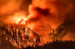
I’ve found there is huge public interest and concern about the catastrophic effects of the Eagle Creek Fire on the Columbia River Gorge. Pictures of ridgeline after ridgeline enveloped in bright orange fire, trees bursting into towering flames, and the choking smoke that filled valleys throughout the Pacific Northwest are
National Geographic has published an outstanding article, “Formed by Megafloods, This Place Fooled Scientists for Decades”, about J Harlan Bretz and his outrageous, fantastical theories of a landscape shaped by huge floods. Most Ice Age Floods aficionados are generally aware of the story, but this one is so detailed and

This 3:50 minute animation, presented by the Crown Point Country Historical Society, illustrates the growth of the Cordilleran Ice Sheet, the damming and back-up of Glacial Lake Missoula, and the progress of an Ice Age Flood through WA and OR after an ice dam collapse.

The Washington Geological Survey (formerly the Division of Geology and Earth Resources) has just released an ESRI story map about the Ice Age Floods in Washington. The story map: “tells the story of cataclysmic outburst floods that shaped the landscape of the Pacific Northwest during the last ice age. With
Robert Frost finished his poem “The Road Not Taken” with this verse: I shall be telling this with a sigh Somewhere ages and ages hence: Two roads diverged in a wood, and I— I took the one less traveled by, And that has made all the difference. As our President Gary Ford has