|
|
|
|
|
We hope you enjoy our newsletter and we appreciate any questions, comments or corrections by email to our Webmaster/Newsletter Editor: Lloyd DeKay
|
|
|
|
Explore the Ice Age Floods ... and More
|
|
|
|
|
|
|
|
|
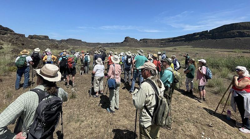
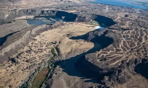
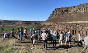
There can be no better way to celebrate the 100th anniversary of the Ice Age Floods story than with a bunch of Floodies exploring the Grand Coulee. On June 1-3 over 80 members and guests of the Ice Age Floods Institute celebrated the 100th anniversary of J Harlan Bretz’s initial paper proposing the Ice Age Floods story. The attendees enjoyed a weekend of Floods-related hikes and field trips, presentations, meals together, and an in-person chance to renew old friendships and establish new ones, in the uniquely majestic setting of Dry Falls and the Upper and Lower Grand Coulee.
|
|
|
|
The event kicked off with Sun Lakes State Park Ranger David McWalter giving an evening presentation about the historical development of the Grand Coulee, and the ranchers and researchers who led to the recognition and development of Dry Falls, the local towns and the state park.
|
|
|
|
The next morning Ranger McWalter talked with a local elementary school class under the historic Vista House Overlook, also attracting a number of Floodies attending the Jubilee. He then moved the Floodies to the Visitor Center for a presentation using the WA-DNR/Geological Survey’s “Washington's Ice Age Floods” storyboard and his amazing 12’x35’ immersive view screen (the Visitor Center windows looking out on Dry Falls).
|
|
|
|
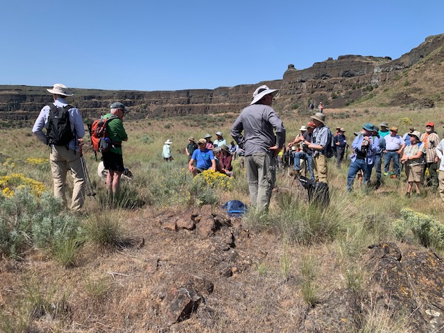
A bit later the attendees gathered at the Camp Delany Retreat Center where Dale Lehman led a hike along the east side of Umatilla Rock to view the plunge pools below Dry Falls. The line of hikers stretched out for a quarter mile, but with the heat that day everyone was happy when it was time to return to the cool shade at Camp Delany.
|
|
|
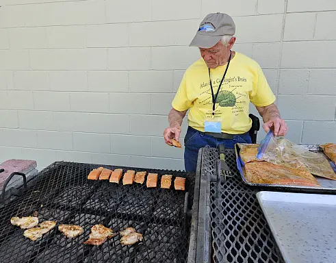
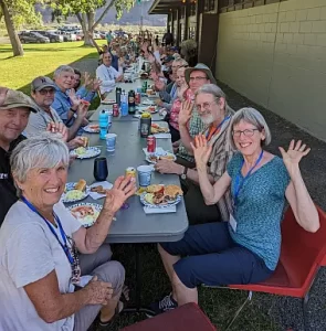
The hike was followed by a perfectly prepared salmon barbecue dinner for IAFI Board members. The dinner also gave board members a chance to get together in-person for the first time in several years.
|
|

|
|
Then all the attendees regathered for elections of 4 board members, a short presentation by several chapter presidents of significant recent and future chapter activities, an update by Justin Radford about the Ice Age Floods National Geologic Trail, and finally a photo-rich slideshow of Ice Age Floods Features by Bruce Bjornstad.
|
|

|
|
The next morning most attendees gathered for a simple continental breakfast before heading out on one of three car caravan field trips exploring key features of the Grand Coulee system, led by either Dale Lehman, Brent Cunderla or Bruce Bjornstad. Stops included the Dry Falls Visitor Center, Crown Point above Grand Coulee Dam, Northrup Point, Summer Falls, Soap Lake, and, for some, a stop at the trail to Lake Lenore Caves. Click here to check-out the field trip guide.
|
|
|
|
As a finale, everyone returned to Camp Delany for the Members & Friends Appreciation Dinner of burgers and brats, and a talk by Jim O’Connor and Isaac Larsen about the GSA Penrose Conference on Massive Outburst Floods that convened the following week at Camp Delany. That was followed by closing remarks from the Jubilee organizer, Dale Lehman, and the IAFI President, Gary Ford.
|
|
It was great that so many members could get together in-person again to enjoy each other and a full program of Floods-related activities. Plans are already in the works for the next two years of membership meetings in 2024, organized by the Cheney-Spokane Chapter, and 2025, organized by the Columbia River Gorge Chapter. Keep tuned to the website for more information as plans progress.
|
|
|
|
|
|
|
|
|
|
|
SOME LOCAL NORTHERN IDAHO ICE AGE FLOODS and GLACIAL FEATURES
|
|
|
|
|
|
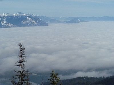
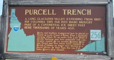
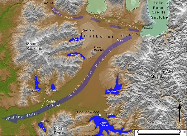
Purcell Trench - This structurally formed valley became the passageway for the Purcell Ice Lobe that divided into five glacial sub-lobes. The east moving sub-lobe blocked the Clark Fork River forming Glacial Lake Missoula, the source of the Ice Age Flood waters. Other sub-lobes modified and deepened the basin now occupied by Lake Pend Oreille or helped define several important N-S transportation routes. The Purcell Trench is visible from City Beach in Sandpoint and Schweitzer Mountain Rd. Hwy 95 follows the Purcell Trench from Sandpoint to beyond Bonners Ferry.
|
|
|
|
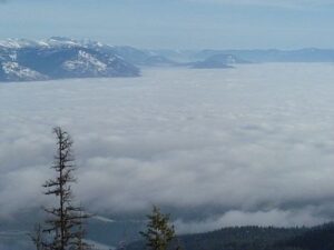
Ice sheet-like clouds fill Purcell Trench
|
|
|
Cabinet Gorge - Contact of Pleistocene Ice and Glacial Lake Missoula Water - Although the contact of the Pleistocene Ice and the lapping waters of Glacial Lake Missoula was in flux as the glacier advanced and retreated, the Cabinet Gorge is considered by many to be a likely location of the terminus of the Clark Fork sub-lobe that blocked the drainage of the Clark Fork River. Evidence of glacial erosion and till deposits indicate glaciation; however, flood deposits on the south side of the river attest to Ice Age flooding. Cores taken during the construction of the Cabinet Gorge Dam suggest multiple stages and events of ice damming. An AVISTA maintained viewpoint at the Cabinet Gorge Dam with Ice Age Floods signage provides an excellent location to ponder the formation and disintegration of the ice plug blocking the Clark Fork River.
|
|
|
|
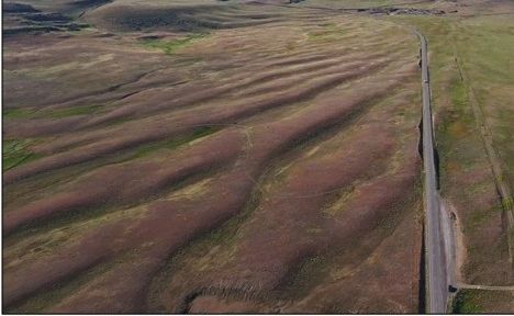
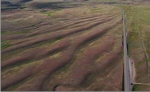
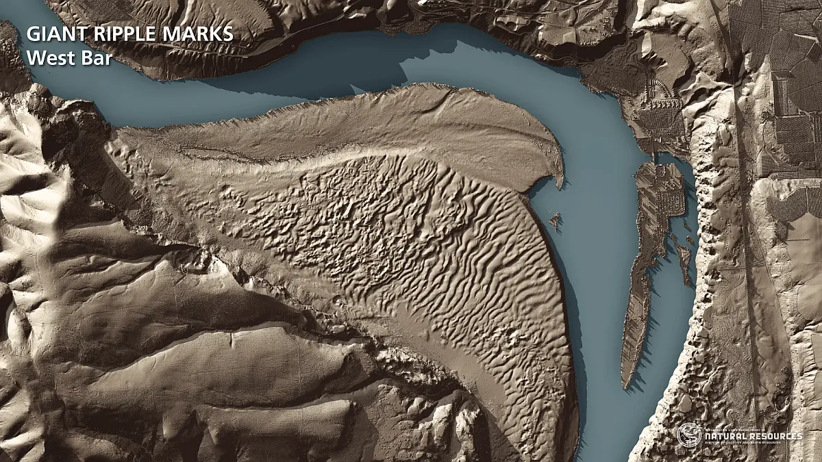
Giant Current Dunes or MegaRipple Marks - One of Bretz’ most important pieces of evidence for catastrophic flooding was the “giant current dunes.” These large-scale bedforms appeared as patterns of parallel ridges and swales on many aerial photographs in the flood channels in the scabland of Washington, but had escaped recognition from the ground because of their size. Giant Current Dunes are visible west of Clark Fork near Castle Rock; however, the most prominent and visible Giant Current Dunes are located several miles east of Spirit Lake along Hwy 54 where the highway cuts through the dunes showing their undulating profile. The location of many of the telephone poles on the crest of these dunes accentuates these landforms.
|
|
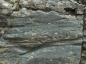
The dunes form transverse to the current direction, and form cusps that are convex upstream, with arms that point downstream. Furthermore, the size of the cusps appears to decrease in the direction of lower velocity. Internally, the dunes consist of gravel and pebble foresets. Giant current dunes exhibit an asymmetrical profile with the downstream (lee) slope steeper than the upstream slope. Crests range from 20 to 200m apart and heights range from 1 to 15m (Baker and Nummedal, 1978) and are among the largest measured throughout the Floods area. The Spirit Lake current dunes can also be easily recognized from the air by their characteristic pattern, accentuated by vegetation. This dune field is immediately in the path of the breakout from Lake Pend Oreille, and experienced some of the highest energy flows.
|
|
|
|
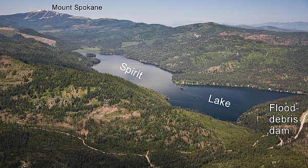
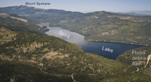
Debris-Dammed Marginal Lakes - There are at least eight prominent debris-damned lakes associated with the Ice Age Floods located along the margins of the Rathdrum Prairie Outburst Plain. One of the more accessible and easily viewed is Spirit Lake located just west of the town of Spirit Lake on Hwy 41.
|
|
Hoodoo Channel - The Hoodoo Channel most likely represents the major outlet for the later Ice Age Floods. This flood channel cuts into the Rathdrum Prairie beginning at Bayview and crosses Hwy 95 approximately three miles south of Careywood where it is easily seen.
|
|
|
Pendant Bar - The large sharply defined topographic feature of megaflood deposits on the lee side of Round Mountain is a “Pendant Bar.” The feature is more easily definable by the change in land use from agricultural land to a rougher forest/shrub landscape of erratics of all sizes deposited heterogeneously with sands and gravels in the flood shadow down flow of Round Mountain. This feature is located at the intersection of Hwy 41 and Scarcello Road south of Spirit Lake near Twin Lakes.
|
|

|
|
|
Glacial Striations - Striations can be viewed along Hwy 200 east of Hope and on the south side of Castle Rock east of Clark Fork.
|
|
|
|
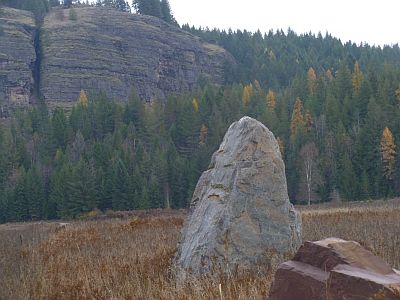
Glacial/Flood Related Erratics - Large and small erratics cover the glacial and flood modified landscape. Large erratics can be seen along Hwy 200 east of Clark Fork, in Sandpoint’s City Beach and in Farragut State Park. A large pile of erratics excavated from flood deposits are visible on the west-side of Hwy 95 south of the Hoodoo Channel. A giant ice-rafted flood related erratic weighing over 1,600 tons is located on the east-side of Hwy 41 near Twin Lakes.
|
|
|
|
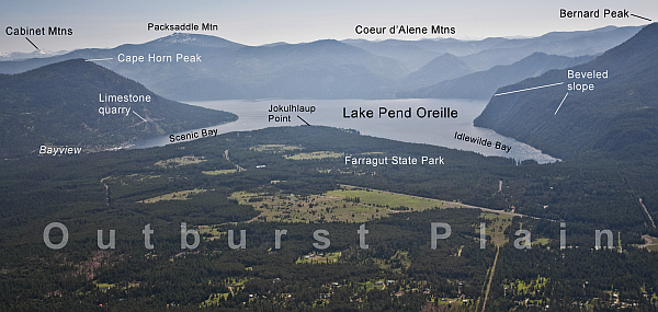
Lake Pend Oreille - This is where it all started! Lake Pend Oreille is the largest lake in Idaho and the deepest lake in the Pacific Northwest and the 5th deepest in the US. The lake level is 2062 ft above sea level with depths over 1,000 feet and an additional layer of over 1,500 feet of glacial-fluvial deposits going to bedrock, with the surrounding terrain as high as 6002 ft. The glacially modified U-shaped bedrock valley, cut to approximately 600 feet below sea level, was formed by the Pend Oreille glacial sub-lobe. This glacial sub-lobe was up to 4,000+ ft. thick and 30+ miles wide. It was the ice plug responsible for blocking the Clark Fork River. It collapsed catastrophically as often as about every 10-60 years, releasing 40-100 Ice Age Floods.
|
|
The location of the lake is probably related to an old river valley controlled by faults. The Lake Pend Oreille basin was carved by the repeated advances of Pleistocene ice and scoured by ice age floods. With the waning of ice age flood waters, the basin was, and continues to be, filled with glacial outwash and flood deposits. The lake is dammed at the south end by thick glacial and flood deposits the mark the beginning of the “Outburst Deposits”. There is a pullout on Hwy 200 approximately one mile west of Hope with signage already established that provides a great view looking south across Lake Pend Oreille to the Green Monarch Mts. Another view of the former ice plug location along Hwy 200 is the mouth of the Clark Fork River at the Clark Fork Drift Yard.
|
|
|
|
Rhythmites - are glaciolacustrine sediments associated with flood events and are useful in attempting to determine the number of Ice Age Floods. A 112-foot cross-section of rhythmites is located at the junction of East Fork Creek and Lightning Creek approximately 6.5 miles northeast of Clark Fork along Lightning Creek Road (NF-419).
|
|
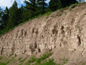
Proglacial Deposits - This type of deposit is found associated with most of the drainages on the south side of the Clark Fork Valley and extend from the mouth of the Clark Fork River to nearly Thompson Falls in Montana. These sediments are glacio-fluvial deposits deposited in contact with the ice and therefore provide evidence of glaciation in the Clark Fork River drainage. The associated geomorphic features formed by these deposits are referred to as “kame deltas”. The gravel pit associated with Dry Creek (approximately 8 miles west of Clark Fork to Dry Creek Road and then about four miles up Dry Creek drainage) provides an exposure of these glacio-fluvial sediments and stratigraphy of these ancestral deltas. The location of proglacial deposits is important as they indicate that the Clark Fork sub-lobe advanced further up the Clark Fork River drainage than previously recognized.
|
|
|
Rathdrum Prairie Aquifer Outburst Plain - A visit to Farragut State Park is a visit to the Outburst Flood Plain. The eastern portion of Farragut State Park, including Bayview and Jokulhlaup Point, is essentially the beginning of the Outburst Flood Plain and the Rathdrum Prairie Aquifer that extends beyond Spokane. The Visitor Center for Farragut State Park is the best spot to begin exploring the Rathdrum Prairie Outburst Plain.
|
|
|
Article by Tony Lewis in January 2017 and later revised based on Field Trip documents prepared by Roy Breckenridge and Dean Garwood along with information from Bruce Bjornstad and Gene Kiver (2012, On the Trail of the Ice Age Floods: The Northern Reaches) Read more
|
|
|
|
|
|
|
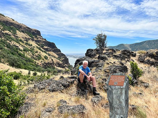
The Lyle Cherry Orchard Trail is a moderately strenuous trail being developed in the Columbia Gorge by Friends of the Columbia Gorge. They envision having a number of interpretive stations along the trail to inform and educate trail users. A station could focus on a single topic, such as the geology, plants, animals, indigenous and cultural history of the area. But they found that the cost of interpretive signs would be prohibitive, would be expensive to maintain and might not last long.
|
|
|
|
So they started brainstorming for better ways to realize thier vision. The came up with a plan to place trailside posts, resembling basalt columns, with a QR code the user could scan with their smartphone that would connect to an informative recording about that location. Friends hopes to have the trail work and information stations finished by 2024. Then everyone will be able to experience the beauty along the Lyle Cherry Orchard Trail with a deeper understanding of their surrounding through the recordings.
|
|
|
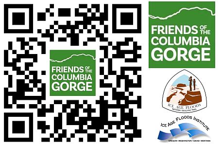
Renee Tkach, a Friends coordinator of the project, contacted Lloyd DeKay, president of the IAFI Columbia Gorge Chapter, about doing a recording for the first station about the geology of the area. They took a very windy hike together on the still somewhat challenging trail to the first station, where they talked about the focus of a recording and took a number of photos to document the views. Lloyd developed a script and produced a 4:30 minute recording. Since the original plan was for a 3:00-3:30 minute recording, the script and recording was cut back and shortened to 2:30 minutes.
|
|
Interest is growing in this method as an easier, economical and useful way to provide information at other floods sites throughout the region. Significant advantages include the relatively low cost and long life of the information station, and ability to provide both video and audio clips for a number of features on a webpage linked to the QR code, and the ability to modify and update the presentations as new or updated information becomes available.
|
|
|
|
|
|
|
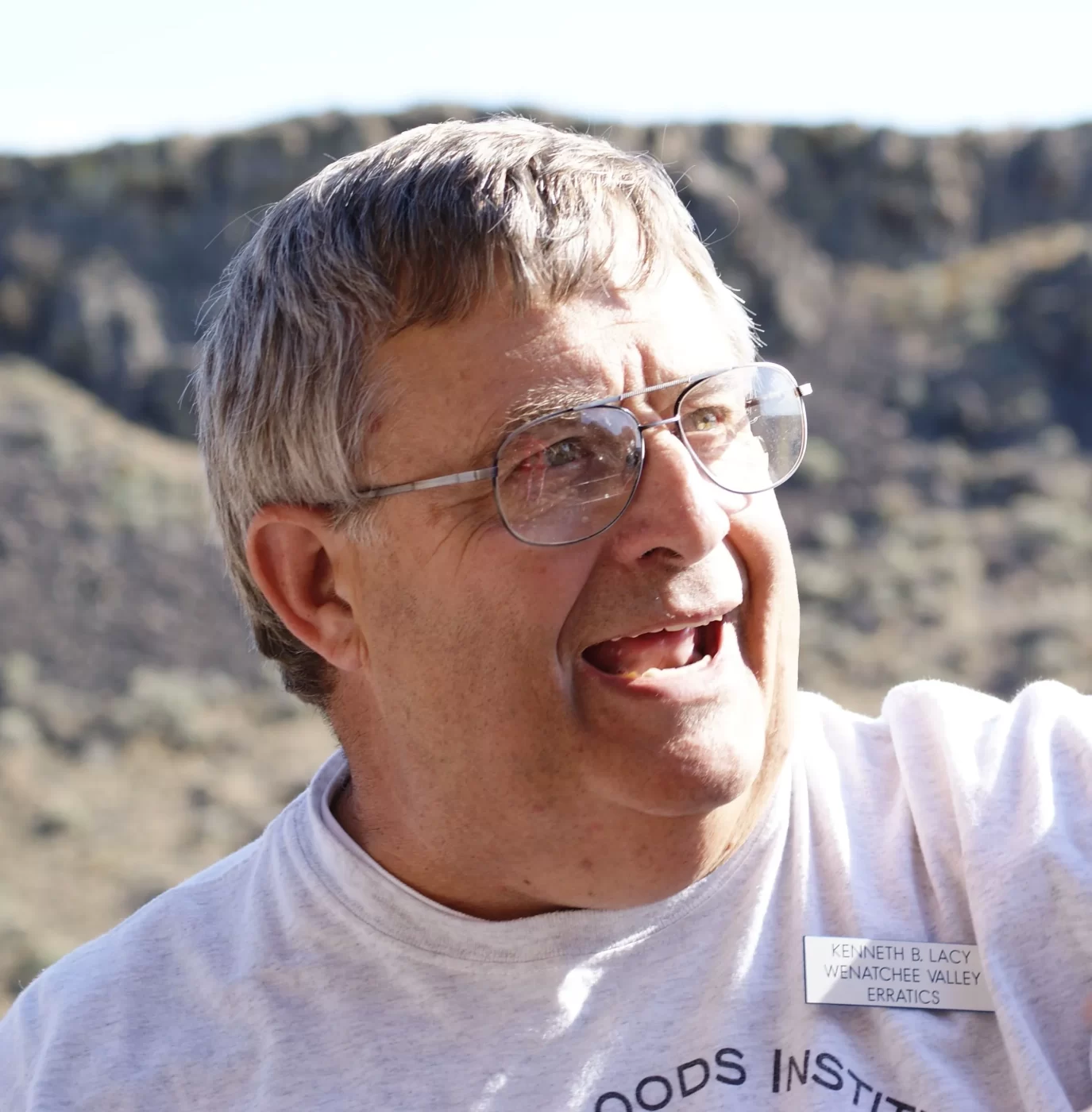
The 2023 GSA Outburst Floods Penrose Conference made a field trip stop on Tuesday afternoon, June 6, at Ken Lacy's (IAFI Wenatchee Valley Erratics Chapter member) home, for a spectacular overview of the West Bar Current Megaripples that can be seen well from that vantage point.
|
|
The purpose of the conference was to review the current outburst floods fieldwork being done, encompassing the range of science conducted both on Earth and elsewhere in the solar system. The 75 conference attendees from all over the world were at the conference by invitation only. They were accompanied by organizers Jim O'Connor, Isaac Larsen, Joel Gobiner, Vic Baker, Richard Waitt, Jerome Lesemann.
|
|
|
|
The timing of the conference coincided with the 100th anniversary of J Harlen Bretz’s first publication on the Channeled Scabland, and took place at Camp Delany, which occupies a spectacular flood-carved setting at the foot of Dry Falls in Grand Coulee, Washington. The conference was meant to review past and present work, as well as help chart the future science on outburst floods through presentations, discussions, and multiple field trips.
|
|
|
Everyone sharing in Ken's hospitality were in particularly good humor, as considerable amounts of cookies, popsicles, and bottled water were consumed. There were many comments about how well the meeting was going and how lots of new insights were being discussed. These kind of comments suggest that the meeting was being extremely well received. Ken was also pleased to talk to Justin Radford, along with his USGS Research Geologist... nice to see them in attendance.
|
|
|
|
|
|
|
Hello from the trail. A lot has been happening over the past couple of months and I’ll start with our new National Park Service interactive web map. Our new web map will help visitors locate and understand the complexity of various Ice Age flood features throughout Ice Age Floods National Georgic Trail. This new map would not have been possible without the support and collaboration of the Ice Age Floods Institute.
|
|
|
|
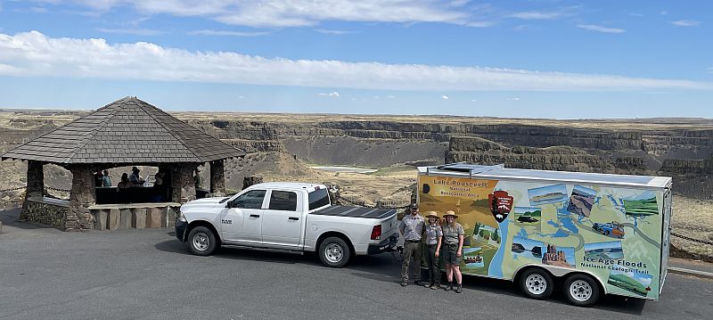
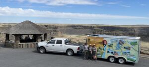
The National Park Service has also been out and about with its mobile visitor center for the floods and Lake Roosevelt National Recreational Area. The trailer was at several Spokane conventions earlier this year and made an appearance at the 2023 Sand Hill Crane Festival is Othello, WA.
|
|

|
|
This year’s Ice Age Floods Institute annual member meeting was a smashing success. The Jubilee was a grand time for many to dig deeper into their experiences with this fascinating story. So many floods’ detectives out walking, hiking, and driving Ice Age Floods National Geologic Trail, I was excited to meet and join with members through presentations, walks and tours in the heart of the Missoula Floods there at Dry Falls and the Grand Coulee.
|
|

|
|
|
Last month the National Park Service was also fortunate enough to participate in the Geologic Society of America 2023 Penrose Conference. This conference focused on Glacial Lake Outburst Floods (GLOFs) and drew presentations from world renowned scientists. Fitting that this conference was also held at Dry Falls on the 100th anniversary of J Harlen Bretz’s first publication about the Channeled Scabland. It was great to see so many people thinking about outburst floods and, of course, several of the presentations focused on the Missoula Floods. Scientists from all over the world are taking various approaches to better understanding the forces at work during massive GOLF events.
|
|
Efforts like dating giant gravel bars help us better understand when events took place, modeling water flow helps us see where water went based on various terrains, and new Light Detection and Ranging (LiDAR) data is helping us see past vegetation to the hidden landscape below. I was most impressed with the scope of efforts underway. From British Columbia, Alaska, and the Tropical Andes, to China, Antarctica, and Iceland, evidence of events like our Missoula Floods are being closely studied across the globe. Also in attendance were members of the twelve Bands which compose the Confederated Tribes of the Colville Reservation. The Grand Coulee and surrounding flood channels are the historic homelands of the Colville Tribe, and they shared cultural connections with the landscape and floods. In all some 70 participants helped create an atmosphere of reverence for a greater understanding of the forces at work changing our planet: then and now.
|
|
|
I would also like to thank our partners at Washington State Parks for not only hosting both events but also for the daily care and respect they show these special places. Don’t forget you are also encouraged to come by the Dry Fall Visitor Center for this year’s Flood Fest, July 22, 11-3pm. See you there! Read more
|
|
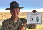
Justin Radford, Ice Age Floods National Geologic Trail Program Manager
|
|
|
|
|
|
|
|
|
There is a recurring and much debated question: Could there have been indigenous people in the Americas to witness the Ice Age Floods? Evidence is building that they could have been here. Let's explore more!
|
|
|
|
|
|
|
|
Nearly 10,000 years ago, Earth came out of its most recent ice age. Vast, icy swaths of land around the poles thawed, melting the glaciers that had covered them for nearly 100,000 years. Why, after such a long period of cold, did the ice age finally come to an end? Scientists are still searching for the answer.
|
|

|
|
The traditional explanation — and short answer — for why ice ages begin and end is a series of eccentricities and wobbles in the planet's orbit known as the Milankovitch cycles that describe patterns in Earth's orbit and axial tilt. Over time, our planet's orbit around the sun alternates from being more circular to more egg-shaped. At the same time, our planet's axis tends to both tilt and wobble. Milankovitch found that these factors combine at regular intervals to cause land at 65 degrees north latitude (a parallel that runs through Canada, Alaska and parts of Eurasia) to become warmer than normal and theorized that this warming and then subsequent cooling of the Northern Hemisphere explained the planet's cycle of ice ages — or glacials — and warmer periods — or interglacials. But this doesn't explain why the ice ages ended in the Southern Hemisphere about the same time.
|
|
|
|
|
|
|
One alternate explanation is that when the Northern Hemisphere began to warm around 13,000 years ago, meltwater and icebergs flooded the North Atlantic Ocean, causing a temporary cooling of the Northern Hemisphere known as the Younger Dryas period (12,900 to 11,700 years ago). There is some evidence that the Younger Dryas affected ocean currents in a way that caused the Southern Atlantic to warm up, stirring up the ocean in the process and releasing tons of stored carbon dioxide into the atmosphere, which in turn caused glaciers in the Southern Hemisphere to melt over the next 1,500 years. The end result was likely a more carbon-rich atmosphere that continued to warm both hemispheres, lifting the planet out of the glacial period.
|
Another hypothesis, published in 2021, suggests that the length and intensity of the Southern Hemisphere's winters could dictate when ice ages end. On the surface, it sounds like the polar opposite of the Milankovitch theory, which suggests that Northern Hemispheric summers drive the climatic changes. However, long winters in the Southern Hemisphere alter wind patterns near the tropics, which can create frequent storms over an area of the Pacific Ocean known as the Tropical Warm Pool — a region of ocean that stores and releases great amounts of heat. Altered winds can create storms in this area, which in turn releases massive amounts of water vapor that can act as a greenhouse gas.
|
Another idea is that salty water pouring from the Indian Ocean into the Atlantic Ocean helped end the last ice age. The Indian Ocean had become super salty because a drop in sea level had cut off a critical current that flows from the Pacific to the Indian Ocean; normally, this current diluted the Indian's very salty tropical waters. A change in wind patterns and currents in the Indian Ocean could have caused the Indian Ocean to dump tons of dense, salty water into the Atlantic Ocean, altering its currents and temperatures in both the Northern and Southern hemispheres.
|
|
More evidence is needed to know for sure if any of these hypotheses can actually explain why the last ice age ended. But glaciologists are continuing to look into this cold case
|
|
|
|
|
|
|
|
|
Indigenous peoples have been in the Americas longer than once thought
|
|
|
|
|
|
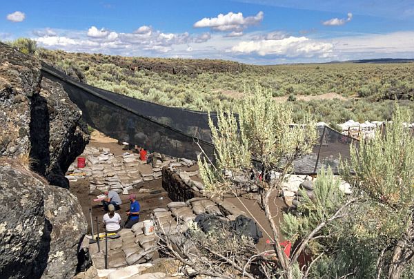
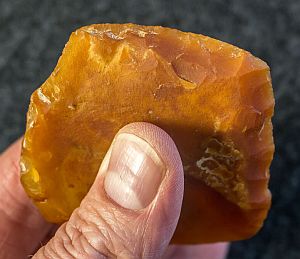
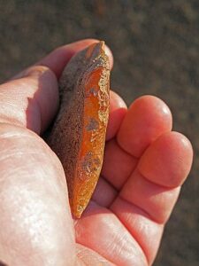
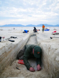
Stone tools unearthed from a rock shelter in Southern Oregon were last used more than 18,000 years ago, radiocarbon dating suggests. That makes the site one of the oldest-known human living spaces in the Americas. Buried deep beneath a layer of volcanic ash, archaeologists excavating Rimrock Draw Rockshelter found two stone scraping tools, which ancient knappers had skillfully shaped from pieces of orange agate.
|
|
|
|
A residue of dried bison blood still clung to the edges of one scraper, a remnant of the last bit of work some ancient person had done with the tool before discarding it. The layer of volcanic ash above the tools had blasted out of Mount St. Helens, a few hundred kilometers north of the rock shelter, 15,000 years ago, long after the fine agate scrapers, and the people who made and used them, had been forgotten.
|
|
|
|
In a layer of dirt below the volcanic ash but above the stone tools, archaeologists found broken teeth from now-extinct relatives of modern camels and bison. Radiocarbon dating on a piece of bison tooth enamel (first in 2012, and confirmed recently by more testing) suggests the teeth belonged to animals that lived about 18,250 years ago. And because those teeth were buried in a layer of dirt above the stone tools, they must have ended up in Rimrock Draw sometime after the tools. That makes the agate scraper, complete with bloody evidence of its use, more than 18,000 years old—and one of the oldest traces of human presence in North America. But the people who lived in Oregon more than 18,000 years ago almost certainly weren’t the first to call the continent home.
|
|
In Idaho, the Nimiipuu (Nez Perce) know the Cooper’s Ferry archaeological site as the ancient location of a village they call Nipehe. The oldest artifacts unearthed at the site date to at least 16,000 years ago, and it looks like people lived there, at least off and on, for several thousand years after those first arrivals. To have reached Cooper’s Ferry 16,000 years ago, the ancient inhabitants of Nipehe would have had to cross Beringia, a land mass that connected what’s now Russia with what’s now Canada during the last Ice Age, when sea levels were lower. They then had to move south along the Pacific Coast of North America, skirting along the western edge of the great ice sheet, until they reached the southern edge of the ice.
|
|
The ice-free corridor wouldn’t open until about 15,000 to 14,000 years ago. By then, people were already living far, far south of the ice: Archaeologists found stone tools and butchered mastodon bones submerged in a Florida sinkhole that dated back to 14,500 years ago. And in Chile, someone left behind a single footprint 14,600 years ago.
|
|
|
Thanks to footprints on an island off the coast of what’s now British Columbia, we know that at least some people did make their way along the coasts about 13,000 years ago. But some archaeologists, like Bournemouth University’s Matthew Bennett and his colleagues, say that those coastal migrants may have found their way into a continent already home to people who arrived at least 26,000 years ago—long before the ice sheets blocked the way into North America from Asia.
|
|
In the mountains of north-central Mexico, archaeologists unearthed stone tools from Chiquihuite Cave, which dated back to around 30,000 years ago. And at White Sands National Monument in New Mexico, it appears that someone walked along the ancient shoreline of Lake Otero (now long since dry) between 23,000 and 21,000 years ago, leaving behind a trail of 61 footprints. Archaeologists dated the White Sands footprints thanks to grass seeds trapped in the layers of clay and silt above and below the tracks, which helped bracket their possible age.
|
|
|
|
Some archaeologists are still skeptical, partly because there are so few sites this old south of the ice sheets, but there’s enough evidence to take the claims seriously.
|
|
|
|
|
|
|
|
Related Articles On Our Website
|
Do you have a question? We might have an answer!
Do you have a fact to share? We have a way to do that!
|
|
Members who want to do a short article, or describe a field trip location of interest, or describe a problem or some geologic site, can use our online form to submit a question or write-up to our technical committee for an answer or review before we post it on our Question Corner page.
|
|
|
|
|
|
|
|
| Thursday, July 20, 7:00 pm – 8:00 pm |
The National Ice Age Trail in Tualatin – LCC Talk @ Tualatin Heritage Center |
| Saturday, July 22, all-day |
Dry Falls “Floodfest 2023” @ Dry Falls Visitor Center and Vista House |
| Saturday, July 22 @ 1:00 pm – 3:00 pm |
Dishman Hills Natural Area Hike with Michael Hamilton @ Dishman Hills Natural Area, Camp Caro |
| Thursday, Aug 17, 7:00 pm – 8:00 pm |
Vic Baker – “My Personal Interactions with J Harlan Bretz” @ Tualatin Heritage Center |
| October 19, 2023, 7:00 pm – 8:00 pm |
Lahar Early Warning Systems – Why Mt Rainier is the Most Dangerous Volcano in the US - Zoom Lecture by Bill Burgel |
|
|
|
THANK YOU IAFI MEMBER SUPPORTERS
|
Every member at every membership level is vital to IAFI’s continued success. Your support helps us meet our mission of providing the Ice Age Floods story to the public and continuing our work on the Ice Age Floods National Geologic Trail. Every gift counts, no matter the size. Thank you for making the IAFI what it is today and for helping shape it for the future.
|
|
|
|
|
|
Ice Age Floods Institute (IAFI) is a 501(c)(3) tax-exempt, non-profit educational organization (EIN 91-1658221), founded in 1995 and recognized as an official authority on the Ice Age Floods, providing accurate, scientific-based advice to members and the public. We were instrumental in 2009 Federal legislation authorizing National Park Service designation of the
Ice Age Floods National Geologic Trail (IAFNGT).
|
|
|
|
|
|
|