NPS Photo
 BASALT
A dark igneous volcanic rock composed of primarily two minerals: plagioclase and pyroxene. Over a period of 11 million years (17 to 6 million years B.P.) hundreds of flows of Columbia River basalt were extruded from long, linear vents in southeastern Washington, northeastern Oregon and west-central Idaho and traveled for hundreds of miles before cooling and solidifying to form the Columbia Plateau.
NPS Photo
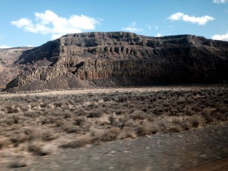
 BUTTE
BUTTE
A conspicuous, isolated, generally flat-topped hill with relatively steep side slopes, often capped by a more resistant layer of rock and bordered by talus. Often represents an erosional remnant, smaller in extent than that of a mesa, carved from flat-lying rocks.
NPS Photo
 CHANNELED SCABLAND
An eroded, interconnected network of streamlined loess islands, flood channels, coulees, cataracts, and plunge pools scoured into basalt by cataclysmic floods in eastern Washington State. These features are unique to this region of the Earth, however they are similar to channel networks observed on Mars.
NPS Photo
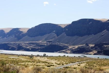
 COULEE
A long, dry, steep-walled, trench-like gorge or valley representing an abandoned river channel. In south central Washington, the term coulee is mostly used for an abandoned ice-age flood channel.
NPS Photo
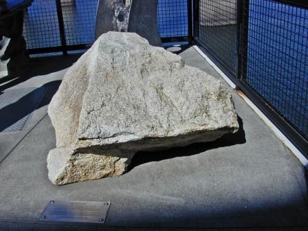 ERRATIC
A rock fragment carried by floating ice, deposited at some distance from the outcrop from which it was derived and generally composed of a different type of rock than the local bedrock.
IAFI Photo
 GIANT CURRENT RIPPLES – GCRs
Extremely large waveforms created by the transport and deposition of coarse-grained* flood material during Ice Age floods. They develop at right angles to the direction of flow, much the same as the smaller ripples we see along modern beaches and river bottoms. GCR’s, composed of coarse-grained sand and gravel, have wavelengths of 100-400 ft and amplitudes of 3-25 ft (Baker 1978). NPS Photo
 HANGING VALLEY
A tributary valley whose floor is notably higher than the valley it joins. Characteristic of flood coulees, where flat valley floors suddenly drop off abruptly at one or both ends where they join adjacent coulees.
NPS Photo
 TALUS
TALUS
Broken rock fragments from a steep slope or cliff that accumulate at the base, typically forming an apron of loose rubble.
NPS Photo
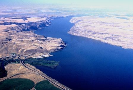 WALLULA GAP
The narrow constriction, only a few miles wide, through which all floodwaters from glacial Lake Missoula passed on their way to the Pacific Ocean. During the largest floods, the water within Wallula Gap was over 1,200 ft deep.
NPS Photo