In August, Scott David, a postdoctoral researcher and Karin Lehnigk, a 2nd year PhD candidate from the University of Massachusetts visited the scablands for a week to do field studies.
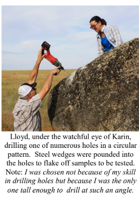
Karin was in search of granite erratics. Samples of these were taken to be processed for Beryllium-10 exposure dating, a robust geochemical technique which enables researchers to determine how long the object sampled has been sitting on the surface of the Earth. This information combined with computer simulations of a range of flood sizes is to test the hypothesis that the earliest floods through the Cheney-Palouse Scabland Tract were also the largest.
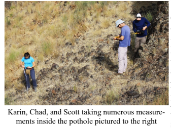
Scott was in search of potholes. Measuring the geometry of potholes and the rocks that comprise them in a variety of locations, he is using these measurements in numerical and physical modeling experiments to explore what erosion mechanisms could generate these massive features. Were they produced by retreating waterfalls, rocks circulating at the base of the flow, large scale turbulence, or some combination of these mechanisms? The results of the study should provide insight into how the remarkable canyons that comprise the Channeled Scablands formed.
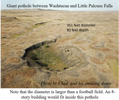
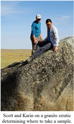
On a Friday afternoon, I met up with them in Ritzville and proceeded to some granite erratics near Cow Creek southeast of town to take samples. They spent the night at our house in Washtucna and were thrilled to have hot showers, a home-cooked meal and soft beds. The days before they slept in tents on a gravel parking lot. The next morning, Chad Pritchard from EWU joined us as we took measurements from four pot-holes along the south side of Washtucna Coulee between Washtucna and Hooper. They also took granite samples from the Midcanyon Bar near Lyons Ferry before returning to the Grand Coulee area. The results of their studies were not available at time of printing.
Article by Lloyd Stoess in The Scablander